
Vellinge is a compact service town set amid the broad farmland of Söderslätt, not a seaside resort despite its proximity to the Falsterbo peninsula. Its centre is best read in layers: the church village and farm landscape came first, the railway brought a station-town boom, and buses now connect the municipal centre to the coast and the Malmö–Lund region. Statistics Sweden counted 7,274 residents in the statistical built-up locality of Vellinge on 31 December 2023. That figure describes the SCB-defined tätort, not the whole municipality.
A village in an old agricultural landscape
There is no reliable founding year for Vellinge. The municipality's cultural-environment programme treats the name's age and the first permanent settlement as interpretations: the name may reach back to the Migration Period or Viking Age, while the village probably took shape in the 11th or 12th century. That is a plausible history of settlement, not a dated record of a town being founded. The surrounding plain explains the pattern. A cadastral map from 1770 shows about thirty to thirty-five medium and large farms, fields worked in a three-field rotation and a compact village core beside its church.
The land reform known as enskiftet reached Vellinge in 1808–09. Some farms moved out toward their fields, streets were straightened and smaller houses filled parts of the settlement. An inn served travellers before the railway arrived. Together, farming, roadside trade and parish life made Vellinge a central place in a region of closely spaced villages and churches. The municipality's name study itself is cautious; a modern reader should keep its proposed early dates in the realm of historical interpretation.
The railway town—and what remains
The Malmö–Trelleborg Railway reached Vellinge in 1886. Its station helped turn the older village into a busier service and trading centre; workshops, shops and businesses connected to agriculture found a wider market. A separate line from Vellinge toward Skanör and Falsterbo opened in 1904, making the coast more accessible to summer visitors. Vellinge's station building was replaced in 1903 and later demolished. Passenger service at the station ended in 1971. The railway is therefore part of the town's story, not a current way to arrive.
Today the old railway is recalled in street names and the centre's layout, while municipal and everyday services, shops and the library give the town its practical role. Vellinge Library is at Ängavägen 23. The church stands at the Malmövägen–Östergatan junction, with a churchyard that offers a quiet pause a short walk from the centre. The parish dates the oldest fabric to the 13th century and describes a Romanesque beginning; the municipality's heritage programme places it in the 12th-century church-building wave. The exact dating is not settled by those accounts. Later layers are clearer: the west tower dates to the 15th century and was altered in the late 18th; the altar is dated 1608, the pulpit 1606, and C.G. Brunius restored the church in the 19th century.
Walk the centre, then follow the plain west
A short, self-guided circuit can link the church, the old village streets around Malmövägen and Östergatan, and Stortorget. The municipality lists three exercise loops within Vellinge that follow existing roads and pass an outdoor gym; consult the current local map for exact route lengths and crossings. Its 2025 cycling map shows a wider network of cycleways and low-traffic roads through the agricultural municipality, with places to visit from the village lanes to the Falsterbo peninsula. These mapped links are more useful than assuming the old railway bed is a public trail.
Vellinge is also a practical base for nearby Hököpinge and Västra Ingelstad, and for a separate excursion toward the coastal settlements of Höllviken, Skanör and Falsterbo. Current municipal information says buses serve these places and towns including Malmö, Lund and Trelleborg. Trains run on the Trelleborg–Malmö line at Västra Ingelstad and Östra Grevie, not in Vellinge itself. The town's appeal is its change of scale: an unhurried church-and-market centre backed by a working farm region, with open-air routes and saltwater landscapes reachable by a planned onward trip. Check bus departures, church access, library services and route conditions before setting out.
 Tre filmer från Vellinge: centrum, kyrka och kommunal utveckling
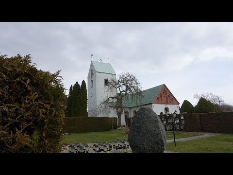 “Vellinge kyrka Skåne,” uploaded by KulturarvSverige - Kyrkor, is a distinct church-focused clip. It complements a stop at the parish church, but the parish remains the authority for the building’s history, access and current opening information.
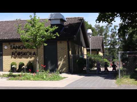 Siemens Knowledge Hub’s “Vellinge - A Pioneering Swedish Village” is about the municipality-wide sustainability and infrastructure initiative, not a Vellinge-town sightseeing route. Treat it as a supplier-produced, older context piece; its claims should not be read as current municipal statistics or visitor guidance.