
A working coast that became a place to linger
Lomma faces the Öresund at the mouth of Höje å, where a former industrial harbour now sits beside a sandy bathing beach, a small-boat marina and everyday town services. The change of use is visible rather than concealed: older brickwork and harbour structures share the shoreline with newer housing, cafés and the public library at Hamntorget. Lomma’s appeal comes from that meeting of working port, coastal recreation and an ordinary residential centre, not from a single monumental old town.
Statistics Sweden counted 13,699 residents in the statistical built-up locality of Lomma on 31 December 2023. That is the SCB tätort—the contiguous, densely built settlement—not the full municipality, which also includes Bjärred, Flädie, Alnarp and rural land. Lomma’s population figure is therefore narrower than municipal totals often shown in general references.
From a river mouth to an industrial settlement
The County Administrative Board of Skåne describes the river mouth as a location that may have offered opportunities for fishing, hunting and transport in Viking Age or early medieval times. It presents this as a likely landscape advantage, not proof that a particular early settlement stood here. The firmer architectural record includes a medieval church on the site of today’s Lomma Church; by the late nineteenth century that building was considered too small for a growing population and was replaced in 1871–73.
Brick shaped the next chapter. Municipal heritage histories trace local brickmaking back to the late seventeenth century and describe a decisive expansion during the nineteenth century, when clay from the area supplied a network of works along Höje å. The harbour and railways carried the products outward. In 1871 Skånska Cementaktiebolaget was founded; a cement factory opened in Lomma in 1872, using local clay and limestone shipped from Limhamn. The county profile identifies a surviving brick loading shed and a customs watch hut as reminders of that private industrial harbour. Cement production later moved away, while asbestos-cement manufacture became another major employer; the municipality dates the Eternit factory’s closure to 1977. These are documented industrial phases, not present-day factory operations.
The railway also reshaped the settlement. The Malmö–Billesholm line reached Lomma in 1886, and the regional heritage inventory records how the centre shifted south towards the station, where trade, housing and industry grew together. A separate Lund–Bjärred railway opened in 1901 to serve the seaside resort at Bjärred; it closed to passenger traffic in 1939. Lomma’s streets consequently hold several civic centres at once: the older church village, the station district and the late-1960s Centrumhuset. The former harbour industrial ground has since been redeveloped, while fishing, boating, food businesses and public services remain part of daily life.
Harbour, beach and local services
Lomma’s harbour is still a useful point of orientation. The municipality lists a small-boat marina and harbour services, and its visitor information describes fishing-related activity, cafés and restaurants alongside the public library at Hamntorget. The northern bathing beach, usually called Lomma Beach, lies just beyond the harbour entrance. The municipality describes its shallow water, beach games and nearby Strandfuret walking area; parking, public transport stops, toilets and showers are listed on the official beach page. Swimming is prohibited inside the harbour itself, so follow the local signs and use the marked bathing area.
The older industrial landscape is best read from a respectful distance: some structures survive as traces within a district now used for housing and recreation. The County Administrative Board also notes older workers’ housing, industrial buildings and a protected cultural environment around the church and station. Lomma Church, rebuilt in yellow brick in the 1870s, marks the older village centre; the harbour’s loading shed and customs hut recall the years when construction materials moved through the port. These sites help explain the town’s economy without implying that industrial access is open to visitors.
Coastal walks and nearby excursions
Strandstråket is the municipality’s long coastal promenade, running between Spillepeng in the south and Lödde å in the north. The municipal route page says the path is mainly a walkway or trail and that some sections are hard-surfaced for easier access. Skåneleden stages 11, 12 and 13 also pass through the wider municipality, linking Löddeköpinge, Bjärred, Lomma and Spillepeng; orange route markers and current maps help distinguish the long-distance trail from shorter local walks. Conditions vary along the coast, so check the route planner, weather and access notices before choosing a segment.
For a short visit, pair the harbour with Lomma Beach and the river-mouth landscape rather than trying to walk the whole municipal coast. The municipality’s separate visitor guide also lists Långa Bryggan in Bjärred, a jetty of more than 500 metres with an open-air bath and restaurant; it is a nearby excursion within the municipality, not part of Lomma’s own town centre. Alnarp’s park and castle offer another green outing. Public transport serves the town and beach, but timetables, seasonal beach services and business opening hours change. Confirm them directly before travel, and never assume the harbour is a bathing area.
 Lomma in three views: beach town, harbour and coast
 “Exploring Lomma Harbour (Lomma Hamn) at Dusk | Sweden | 4K UHD” was published by Voyager Journeys on 5 May 2024 and runs 2:12 according to YouTube’s checked player metadata. Its title makes the harbour the subject, complementing the town and shoreline clips. Treat the time-of-day label as the video’s framing, not a current harbour schedule or guarantee of which businesses are open. The municipal port page remains the source for today’s boating services and rules.
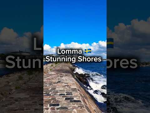 SwedishSoles Adventures published “Lomma's Stunning Shores #Lomma #sweden #summerinsweden #seasidescenery #shore #scania #skåne” on 9 July 2024; the verified runtime is 0:36. The title identifies the shoreline and summer setting, making it a distinct beach-oriented companion to the harbour clip. It is a short, uploader-made introduction rather than an authority on bathing-water quality, beach facilities or seasonal closures; consult the municipality for those practical details.