A harbour between the forest and the tide
Le Faou lies at the head of a tidal inlet on Brest Bay, where the small river of the same name reaches the Aulne estuary. Its old centre follows a narrow strip by the water; the parish church faces the quay, and roads toward Brest, Quimper and the Crozon peninsula meet nearby. INSEE’s 2023 reference population is 1,911 municipal residents. That figure covers the full commune, including Rumengol, attached administratively in 1971, rather than the harbour village alone.
The broad quay can look quiet today, but the setting once made Le Faou a working port. The municipality’s historical account says it was accessible only at high tide and ranked third in traffic among the harbours of Brest Bay under the Ancien Régime. Timber cut in the nearby Cranou forest was brought down to the river and shipped for construction, including Brest’s naval yards. Fairs and markets grew around that exchange, giving the town a role between coast, woodland and inland Cornouaille. The quay is therefore more than a scenic edge: it is the surviving trace of a supply route whose source was the forest and whose destination was the naval city.
Timber-framed houses and the church at the water’s edge
Walk slowly along Rue du Général-de-Gaulle to see how the historic houses make use of narrow plots. The municipal heritage inventory records sixteen surviving timber-framed façades. Their upper floors project over the street; slate cladding protects the frame and gives the buildings their dark, finely layered appearance. Local stone adds contrasting tones. The houses testify to the prosperity of the sixteenth and seventeenth centuries, while later buildings show that the centre continued to change through the nineteenth and early twentieth centuries. Le Faou’s Petite Cité de Caractère and Port d’Intérêt Patrimonial labels recognise this unusual combination of townscape and maritime history.
Saint-Sauveur church faces the harbour. It was built and altered in several stages from the sixteenth through the seventeenth centuries; its openwork western tower is visible from the river. The church, quay and tidal basin form a compact ensemble that explains the old settlement better than any single monument. The town’s discovery circuit links points of interest in the centre and makes a useful short walk. Give the façades time: their overhangs, slate and stone are details best read at street level, not through a car window.
Rumengol’s sanctuary and the legend of its origins
Three kilometres beyond the port, Rumengol adds a different dimension to the commune. Its sixteenth-century Notre-Dame church is a sanctuary associated with the pardons of the Trinity and the Assumption. Nearby stand the fountain of Notre-Dame de Tout-Remède, also dated to the sixteenth century, and the remains of Saint-Jean chapel. The former parish enclosure and open ground around the church help explain how worship and seasonal gatherings shaped this rural centre. Recent municipal interpretation panels invite visitors to learn about the pardons and the fountain on site.
The story that connects Rumengol with King Gradlon and Saint Guénolé should be presented as legend. In the local religious narrative, they see a pagan fire from Ménez-Hom and decide to replace a pre-Christian place of worship with a Christian sanctuary. The diocese recounts the tale as part of Rumengol’s devotional tradition; it is not archaeological proof of a documented Druid temple beneath the present church. That distinction lets the story remain part of the visit without turning belief into a verified date. The sanctuary is dedicated to the Virgin and the Trinity, and its pardons continue to bring a living religious calendar to a place otherwise best known for timber, water and woodland.
A working small town, not only a heritage stop
Le Faou still serves its surrounding communities. INSEE counted 90 employer establishments in the commune at the end of 2024; commerce, transport and other services accounted for about 68 percent. The weekly Saturday-morning market at Place aux Foires brings local producers selling bread, eggs, vegetables, dairy products, poultry and honey, alongside the town’s permanent shops and eateries. It is a useful time to see the centre as a place of everyday exchange rather than a preserved set. The establishment figures describe businesses, not the income structure of individual households, so they should not be mistaken for a full picture of local livelihoods.
Visitor services are practical but seasonal. The municipal tourism office operates during part of the year, so check opening days before planning an in-person visit. Park An Aod, beside the ria, provides motorhome pitches and service points within walking distance of the centre. Access for tents and caravans depends on the seasonal opening of sanitary facilities. Local visitor information also lists restaurants and accommodation. The centre is easy to explore on foot; a bicycle or car makes it simpler to include Rumengol and the forest.
Woodland routes and practical access
The Cranou forest links the town’s present landscape with its maritime past. The Armorique Regional Natural Park describes it as the largest state forest in Finistère, covering 1,321 hectares across Le Faou and Hanvec. Marked trails and the GR 37 pass through beech, oak and conifer stands; part of the forest is protected as a Natura 2000 site. Follow current trail notices, particularly after storms or forestry work. A municipal “porch to porch” walk connects Saint-Sauveur in Le Faou with Notre-Dame in Rumengol over about ten kilometres, using part of the greenway. It is a half-day walk that ties the harbour, rural lanes and sanctuary together.
Le Faou is roughly 30 kilometres southeast of Brest and close to the RN 165; the D 770 leads into the centre. BreizhGo lists a coach route between Le Faou and Brest, making the city a practical public-transport gateway. Travellers arriving by train should check the coach connection for their exact date, since service frequencies vary by day and season. The town also works as a starting point for outings toward Crozon, Daoulas, Landévennec and the Aulne valley. Allow time for the port and timber houses, then choose either Rumengol’s religious heritage or the forest paths to see how the commune joins estuary and inland Brittany.
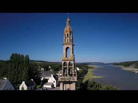 Le Faou in three films: aerial views, local life and a village walk
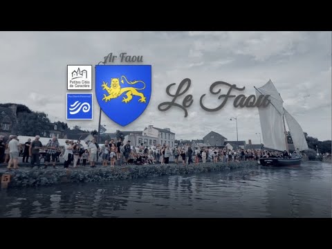 This municipal film presents life in Le Faou through community events, bringing residents and visitors into the frame. It offers a useful counterpoint to an architectural walk because it points toward the social activity that keeps the town functioning beyond its heritage labels. The film is not a calendar of current events, and scenes should not be read as a promise that a particular activity is happening during a visit. Check dates with the town before travelling.
 Chartier Jules Michel’s short film is described as a stroll through Le Faou in Finistère. Its independent, walk-through format gives a different perspective from the municipality’s two films: it invites viewers to spend a few minutes following the village rather than seeing it from above or through an event. Treat it as an impression of the place, not as an official guide, architectural inventory or current access update.