Le Conquet faces the Iroise Sea from the western tip of Finistère, where the estuary, harbour and open coast meet. The commune counted 2,835 residents in 2023, a figure for the whole municipal territory rather than the harbour quarter alone. Its identity is maritime in several practical senses: fishing boats work from the port, pleasure craft use its moorings, and passenger vessels connect the mainland with Molène and Ouessant. That mix gives the waterfront a purpose beyond its postcard view.
A town shaped by the harbour
The old settlement grew where boats could shelter before facing difficult currents around the Brittany headland. Municipal heritage material describes a prosperous maritime and trading town, later damaged during conflict and destroyed in 1558. Many of the historic centre’s houses date from the later sixteenth and early seventeenth centuries. Their stone façades and narrow streets are evidence of rebuilding and adaptation, not a preserved medieval town frozen in one period.
The municipality’s heritage walk also points to older traces on the Kermorvan peninsula, including a Neolithic megalithic site. Local religious tradition links the sixth-century Saint Tugdual with the Christianization of the coast. Those accounts belong to different chapters of the region’s past; neither establishes an exact foundation date for today’s town. A walk through the centre is best read as a sequence of maritime eras: fortified houses and merchants’ residences, later civic and religious buildings, and a working harbour still tied to the islands.
Since 2018, the built and landscape setting has been protected as a Site Patrimonial Remarquable. The protection includes more than isolated monuments: the relation between the ria, the stepped townscape, the rocky points and the open sea is part of what makes Le Conquet distinctive. Look for the old houses around the port, then climb through the central streets toward viewpoints over the water. Local visitor routes help identify buildings without confusing every old façade with a named monument.
Fishing, island links and everyday life
The port remains a working place. Fishing, leisure boating and island transport share the waterfront, while goods also move by sea to the islands. The municipality identifies the port as the principal passenger departure point for Ouessant and Molène. A 2024 municipal bulletin reported 25 professional fishing boats and more than 243,000 Penn Ar Bed passengers sailing to the islands from Le Conquet during 2023. These dated figures illustrate the scale of the port’s two roles; they are not a guarantee of current annual traffic.
Fishing is part of the town’s economy as well as its visual character. The local port is known for shellfish and high-quality fish, including brown crab, and the municipality maintains information about local fishing and landing activity. INSEE recorded 649 jobs located in the commune in 2023 and 99 employer establishments at the end of 2024. Nearly seven in ten of those establishments fell into commerce, transport and varied services, with a further share in agriculture, forestry and fishing. These statistics describe formal establishments, not every household or seasonal job.
Visitors find shops, cafés, restaurants and places to stay in and around the centre. The weekly market is listed for Tuesday mornings at Place Llandeilo and Rue Poncelin, with food producers, fish and prepared meals among its vendors. The harbour’s year-round work continues alongside seasonal tourism, so opening hours and availability vary. The town’s services make it a useful base, but its strongest visitor experiences are tied to the sea, walking and carefully timed island trips.
Kermorvan, the lighthouse and the coast
North of the harbour, the Kermorvan peninsula narrows toward its lighthouse. The square tower was commissioned in 1849, stands about 20 metres high and is joined to land by a granite bridge. The municipality’s tourist information says visitors climb 77 steps for views across the harbour, the Molène archipelago and the Blancs-Sablons coast. It has opened to visitors since 2022, but access can depend on season and conditions; check current opening information before setting out.
The long beach of Blancs-Sablons lies beside the dune system north of town. Municipal visitor material describes roughly 2.5 kilometres of sand and surf, with views back toward Kermorvan and the fort on Îlette. The beach is part of a protected coastal landscape, not just a bathing stop. Wind, tide, currents and surf can change quickly; follow local signs and conditions, especially if swimming, surfing or walking near the water.
Southward, the GR34 coastal path leads toward Pointe Saint-Mathieu, where the remains of an abbey, a lighthouse and exposed cliffs make a memorable longer outing. The route offers a wider reading of the shoreline than a short loop through the centre. Choose a section that matches the weather and your ability, and check trail status before walking. The nearby headland and the village can form a full day without rushing from one attraction to another.
How to arrive and plan the visit
From Brest, BreizhGo/Penn Ar Bed coach route 911 connects the city with Le Conquet and its harbour; current timetables and stop names should be checked for the date of travel. Penn Ar Bed operates crossings to Ouessant and Molène, with schedules that change through the year and may be affected by sea conditions. Some island tickets include a coach connection from Brest under the operator’s conditions. If the ferry is the main purpose of the trip, book and verify the complete journey rather than planning around a generic daily timetable.
A thoughtful itinerary begins with the old harbour and centre, continues to the Kermorvan lighthouse or Blancs-Sablons, then leaves time for a market, a meal or an island crossing. Nearby Pointe Saint-Mathieu and the coast toward Plougonvelin extend the visit along the same Atlantic edge. Le Conquet’s significance lies in this close relationship between a living port, rebuilt historic streets and an exposed natural setting. The sea is not scenery around the town; it is the reason the town developed and the condition that still shapes a visit.
 Le Conquet in three films: harbour, Kermorvan and the GR34 coast
 The Iroise tourism office focuses on the Kermorvan peninsula and its lighthouse, describing the walk to the headland and views toward Molène, Blancs-Sablons and the harbour. This is the most direct preview of the coastal landscape from Le Conquet. The video description says the lighthouse welcomes visitors, but access and opening arrangements can change; confirm current details before planning around the climb.
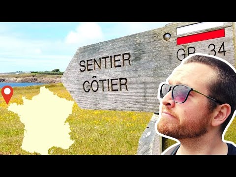 Jerry Walks follows the GR34 from Plougonvelin toward Le Conquet by way of Pointe Saint-Mathieu. It is a longer coastal outing rather than a short town-centre stroll, and the route’s exposed sections make weather and footing important. The footage offers context for linking Le Conquet with nearby headlands on foot; check current waymarks, route conditions and local safety notices before setting off.