Villejoubert sits where the settled Charente countryside meets the southern edge of the Boixe forest. The commune is small and quiet: its identity comes less from a busy central square than from paths, scattered homes, working land and the long wooded horizon. INSEE records 381 municipal residents for the whole commune in its 2023 reference population, in force from 1 January 2026; the total population is 384 when three people counted separately are included. These figures cover the municipal boundary, not just the village centre.
Much of the landscape story is still visible on foot. The community’s 2024 bulletin says that about 270 hectares of the commune are forested and describes Villejoubert as a place between Angoulême and Ruffec, close to the N10. It also reports that the commune had no shops at that time, with nearby Saint-Amant-de-Boixe supplying many everyday services. A farm at the Chalet de la Boixe appears on the official Macarine walking route, a useful reminder that the woodland edge is part of a lived and worked rural landscape, not a landscaped park. The same bulletin recalls an older local difficulty: residents once had to fetch water from neighbouring communes. A water tower, supplied from the Puits des Prains spring about 2.5 kilometres away, was inaugurated on 5 August 1934 and decommissioned in 1984. That story gives the village’s water tower an unusually personal place in its history.
Villejoubert’s best-known earlier site is Andone, but its archaeology needs careful wording. Excavations found a much earlier occupation sequence, including an Iron Age burial mound and Roman-period remains. The fortified residence itself was built for the counts of Angoulême in the second half of the 10th century; it was an early medieval comital stronghold, not simply a Gallo-Roman fort. Research places its abandonment around 1020–1028, when the comital residence shifted to Montignac. The excavations, first led by André Debord and later revisited by Luc Bourgeois’s research team, have made Andone an important source for understanding an elite household around the year 1000. The site is protected as a historic monument, but it is not presented as a regular walk-in attraction; check access locally and respect property and site boundaries.
Other layers are easier to encounter from the public paths. In the village, the parish church of Saint-Lazare, formerly a priory, holds the bronze bell called Marie, dated 1634 and protected as a historic object since 1944. The Logis de la Barre stands near Andone: the Ministry of Culture records the fief in 1487, dates its main building campaign to the late 15th or early 16th century, and lists the property as privately owned and protected since 1990. Enjoy the view from the marked trail rather than entering the grounds. In the forest, the ruins of the 12th-century Macarine chapel are also private. The tourism route places them at the presumed site of Saint Amant’s hermitage; that is a local historical hypothesis, while older stories about a pagan sanctuary remain tradition rather than established archaeology.
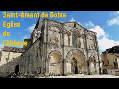
Two marked walks start at Place Jean Moulin. The yellow-marked Macarine loop is 10 kilometres and takes about 2 hours 30 minutes; the Sentier de la Barre is 7.5 kilometres and about 1 hour 50 minutes. The official route pages list parking, free access and year-round opening for the Macarine circuit, and the intercommunal bulletin also notes a Terra Aventura geocaching trail and guest accommodation. The Barre route includes a stretch along the D114, so take care at road crossings. Nearby Saint-Amant-de-Boixe adds an abbey and a Romanesque-architecture interpretation centre. Check the current GPX track, path conditions, access restrictions and opening times before setting out; confirm mairie and abbey hours directly.