Oripää is a small rural municipality in Southwest Finland whose quiet scale hides an unusually rich set of reasons to stop: the headwaters of the Aurajoki, a landscape of esker ridges and springs, a historic wooden church, and a pair of intimate museums. The municipality counted 1,264 residents on 31 December 2025 across 117.6 square kilometres. That figure covers the whole municipality, not only its central village. Oripää is best visited as a short countryside itinerary, with time for both the village and the wooded uplands beyond it.
Where the Aurajoki begins
The river story is the most distinctive way into Oripää. The municipality directs visitors from Kangastie along boardwalks and interpretive signs to the Aurajoki headwaters on Oripäänkangas. The surrounding esker is a groundwater landscape: water divides in several directions here, with the Aurajoki flowing toward the Archipelago Sea, the Yläneenjoki toward the Bothnian Sea, and the Hanhijoki rising at Myllylähde before joining the Loimijoki system. At the source, the river is still a narrow beginning rather than the broad, historic waterway familiar farther downstream near Turku.
Local tradition gives the river a more dramatic origin, telling of a giant ploughing with oxen whose furrow became the Aura. It is a folk explanation, not geology. The physical story is more interesting in its own way: groundwater, sandy ridges and peatland feed a watercourse that later becomes central to the cultural landscape of Southwest Finland. Near the village, Teinikivi is a large erratic boulder beside the old Huovintie route. The municipality says it was protected as a natural monument in 1940 and served as a landmark for travellers over many generations.
A village shaped by parish life and rural work
The present municipality was established in 1869, while Oripää became an independent parish in 1901. Its current wooden cruciform church, completed in 1827, stands in the village beside the trace of an older church site. The municipality records that the earlier church was used until 1821 and demolished in 1843; the oldest bell in today's church dates from 1750 and had already called worshippers at the former building.
The Kivimakasiini local museum makes everyday rural history tangible. The stone building was planned for 1912 but completed in 1915 as a parish granary for seed and food grain in lean years. It opened as a museum in 1986, with exhibits on 19th-century farming and home life; the Ääri general-store collection, added in 2005, recalls a village shop that served residents for five decades. Another very different visit is Villa Ville, the home and studio of artist Viljo Syrjämä. Built largely by the artist in the early 1950s, it was given to the municipality in 2008 and opened to visitors in 2010. Both museums have seasonal access, so confirm current dates and arrangements before making a special trip.
Ridge trails, a spring and a working countryside
Oripää's outdoors are practical and close to village services. From the Kangastupa recreation centre, a marked route called Polvarinpolku runs for about seven kilometres and has a lean-to along the way. The same area has a 2.7-kilometre illuminated fitness loop, seasonal ski tracks and a forest disc-golf course. At Myllylähde, a substantial spring discharge from the esker gives another reason to explore the municipality's water-rich terrain. Check trail condition, snow and access notices by season.
Farming remains part of local life, alongside small businesses and commuting to nearby employment centres such as Loimaa, Huittinen, Säkylä and the Turku area. Oripää's airfield serves hobby aviation and large events; the best-known is OKRA, an agricultural fair held every other summer. Its next published dates are 7–10 July 2027, so visitors should check the organizer's current information. For overnight stays, the municipality lists cottage accommodation at Toimintaloma and the Krapuranta caravan area; Krapuranta's operator currently describes autumn-to-spring access as self-service, subject to its instructions.
Getting there and planning a visit
Bus travel is possible but needs calendar-aware planning. The current operator lists line 415 between Oripää and Aura on school weekdays, with a connection on line 413 from Aura toward Turku; some services pause during school holidays. Check the operator or Matkahuolto for the exact day, stops and fares before setting out. A car makes it easier to combine the village church and museums with the headwaters, Myllylähde and ridge trails. Café and shop hours can be limited, especially outside event and summer periods, so arrange meals and opening times ahead.
 Oripää videolla: Aurajoen alkulähde, Polvarinpolku ja Aurajoentie
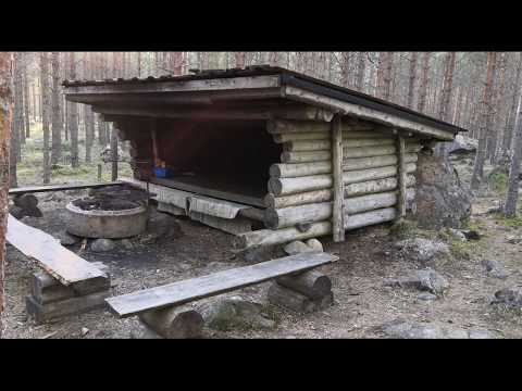 This video is explicitly titled as a seven-kilometre outdoor route with a lean-to in Oripää. That makes it the most practical of the three selections for walkers considering Polvarinpolku, while the municipality's own trail page remains the reference for current maps, access and seasonal conditions. Its focus on a single route complements the river-source film and helps visitors think about time outdoors beyond the village centre.
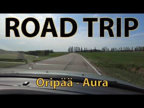 Roadscape's 4K recording is identified by its title as a road trip connecting Oripää, Aura and the Aurajoentie route. It offers a broader route perspective than a single attraction, useful when deciding how to link the village and nearby countryside. The title and publication metadata are clear, but this is not an official timetable or a current traffic report; check road and bus information separately before planning the trip.