Malbo occupies a high, open part of the Cantal, on the southern side of the Plomb du Cantal massif and above the Siniq valley. The commune is officially classed in a mountain zone. Insee counted 90 municipal residents across the entire commune in 2023, with a density of 3.1 people per square kilometre. This figure describes the municipality, not only the small village centre. The official reference population for 2023 is also 90 in total; it came into force in January 2026. At this scale, distances, weather and the pattern of scattered homes matter as much as a central square. Malbo feels less like a compact destination than a quiet mountain territory whose heritage is encountered in the landscape.
Rissergues: a settlement preserved in the ground
The strongest historical evidence lies at Rissergues, around four kilometres north of Malbo according to the Pays de Saint-Flour tourism office. The Ministry of Culture’s Mérimée record describes five buildings and a wider arrangement of paths, walls and terraces connected to an agro-pastoral holding. Some structures were partly set into the ground. Their thick dry-stone walls had earth banks around them for insulation; one building combined a stable and living room, with an upper floor reached by an outside stair. Pottery and charcoal provide the basis for dating occupation to around the year 1000. The hamlet was abandoned before the end of the thirteenth century. This is a documented sequence, not a legend about a vanished village. The protected area was listed as a historic monument in 2013 and belongs to the commune.
On the ground, terraces and dry-stone walls make the relationship between settlement and farming visible. The tourism page adds interpretation panels about mountain life a millennium ago and about archaeological work. It places the site at 1,200 metres and gives two different descriptions of access: April to November subject to snow in one section, and year-round access subject to weather and snow in another. A dirt track continues for about 800 metres after Polverelles and is unsuitable for low-clearance cars; the walking approach from there is listed as 4.5 kilometres. Confirm the opening and track condition before setting out, and do not assume that a listed all-year schedule means the road is safe or passable.
A church above the valley
In the village, Saint-Jean-Baptiste stands above the Siniq. A local heritage guide describes a square bell tower added in 1844 and Romanesque-style carved corbels, alongside later chapels and interior furnishings. Its account also repeats a local explanation connecting a carved wolf head with the name “Cassalouts,” glossed there as wolf hunters. That is an interpretation reported by the guide, not a proven etymology. The Ministry’s Palissy inventory provides a narrower, well-defined fact: a sixteenth-century stone figure called a knight or rider is kept in the church’s first north-side chapel. The volcanic stone is described as probably local trachy-andesite; it was restored in 2016 and protected as a movable object in 1949. The protection applies to that statue, not automatically to the entire church. The ministry notice also cites a 1897 topographical dictionary which says the parish church was a priory given around 1367 to Saint-Flour’s archdeacon and became a subsidiary church in 1808.
Route, landscape and practical preparation
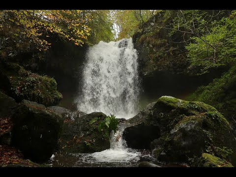
The official mountain-bike circuit no. 10 begins at the entrance to Malbo and forms a 19-kilometre loop. Its published estimate is two hours and thirty minutes, with 373 metres of ascent; the route is marked difficult and red. The tourism office warns of steep gradients. It follows the Siniq valley, reaches the Cascade des Croûtes, notes a small cave formed by water at the waterfall’s base, and passes the Lebréjal plateau orientation table before returning by Vigouroux. A rider may extend the outing toward Rissergues, but this is not presented as an easy walk. The listed year-round availability is conditional on favourable weather and snow cover. Check the current GPX and local conditions, especially in winter or after heavy rain.
Insee recorded 30 jobs located in the commune in 2023. That figure is a workplace count, not a complete description of residents’ livelihoods or the full rural economy. The measurable scale is small, while the pastoral landscape and archaeological remains show a much longer history of working this mountain ground. Malbo belongs to the Saint-Flour community of communes and to the Saint-Flour administrative area. The government directory lists the mairie at 4 rue des Cassalouts and gives 04 71 73 40 39. Its page displays conflicting opening-hour information, so call before visiting rather than relying on a schedule copied from a directory. For Rissergues, confirm access and snow conditions; for the VTT loop, use the current GPX and choose equipment appropriate to a difficult mountain course.