A working town with water at its edges
Bollnäs is a practical, lived-in centre of Hälsingland, shaped as much by railway and commerce as by the river valley around it. The streets lead down toward the Ljusnan and the lakes Varpen and Vågen; forested ridges begin close beyond the built-up area. Brotorget is the everyday hinge of the centre, among shops, cafés, restaurants and cultural venues. Statistics Sweden counted 13,918 residents in the statistically defined built-up locality, or tätort, on 31 December 2023 (code 2183TC102). That is the contiguous urban area within Bollnäs municipality, not the population of the municipality and its outlying villages. The distinction matters here: town life and the wider farming, forest and river landscape are connected, but they are not the same place.
Archaeology, parish church and the railway era
The documented story reaches well before the modern town. At Onbacken, near the centre, a longhouse foundation and nine graves mark an Iron Age settlement dated by the municipality to about 100–500 CE. Bollnäs Church took shape in the fourteenth and fifteenth centuries; the parish records its consecration on 3 November 1468. Its late-medieval wooden sculpture collection is among Sweden’s largest after Vadstena Abbey Church, with altarpieces and figures associated with the workshop of Haaken Gulleson. A municipal landscape analysis suggests that the name Bollnäs may derive from the Långnäs peninsula east of the centre; that is a place-name hypothesis, not a proven origin. The railway brought another decisive change: Bollnäs expanded rapidly after the line arrived, and received town rights in 1942. The Bangården district preserves parts of the railway story: a western engine shed from 1878, a half-timbered forge from 1884, and later sheds now stand beside newer uses.
Culture that still serves the town
The museum and art gallery occupies a building designed by Carl Bååth for the Bollnäs exhibition of 1929. Its early natural-history collection, local archive and library gave the building a civic role; the municipality bought it in 1970, and the art gallery opened in 1995. Today the museum presents local history and the gallery hosts changing exhibitions, so opening is tied to the current programme rather than guaranteed daily. Kulturhuset also houses municipal visitor information, where maps and local guidance are available. In the centre, Brotorget and the surrounding shopping streets offer ordinary services as well as places to eat; this is not a preserved set piece but a regional town where businesses, public life and culture overlap. Bollnäs municipality describes its wider economy as diversified, spanning agriculture and forestry, construction, trade, professional services and manufacturing; those sectors describe the municipality, not jobs located only within the town boundary.
From the waterside to the marked trails
Långnäs is only a short walk from the centre, yet its peninsula feels like a change of pace. A path loops around Lake Vågen for 1.8 kilometres, with parkland, a beach, fishing places and views toward Varpen and Ljusnan. The Folkets Park has been a gathering place since the late 1920s. From the small-boat harbour, S/S Warpen makes seasonal trips along the Ljusnan valley; the municipality records the older steamboat’s last river journey in 1878 and the present operation’s revival about 120 years later. For walking inland, orange-and-white waymarks lead from the centre and Långnäs toward Bolleberget, roughly four kilometres away. Hälsingeleden runs about 160 kilometres between Mosjön and Los, with a main section from Mosjön to Harsa; only selected stretches suit cycling or skiing. Onbacken, the church, Långnäs and the trailhead make a compact visit possible, while Bolleberget extends it into forest. Check trail conditions, transport, museum exhibitions, church access, boat departures and seasonal facilities before setting out; hours and services can change.
 Three Bollnäs films: town centre, Långnäs and church bells
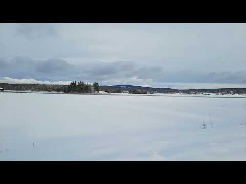 Teum Heng published ‘Bollnäs Långnäs 2023’ on 6 March 2023; the checked runtime is 2:38. The title narrows the focus from the town centre to Långnäs, the peninsula between Lake Vågen and the Ljusnan–Varpen waterscape. That makes it a useful companion when planning a short walk from central Bollnäs toward the park, beach and small-boat harbour. The title and page metadata verify the subject and upload details, but not current facilities or seasonal opening, so check the municipality before travelling.
 Albin Goude’s ‘Bollnäs kyrka, testringning’ was published on 28 June 2026 and runs 4:24. The checked title identifies a trial bell-ringing session at Bollnäs Church, giving this selection a specific sound-and-place angle alongside the general town view and the Långnäs visit. The church itself is a documented medieval landmark, with a notable collection of late-medieval wooden sculpture; the video’s metadata does not establish visiting access, however. Confirm church opening and any service-related closures before planning an interior visit.