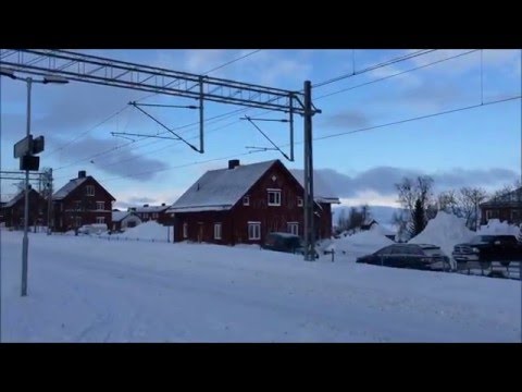
A town made by crossings
Boden is a compact northern Swedish town whose identity is easier to read outdoors than from a single monument. Rail lines meet here, five forts were set into the surrounding heights, and water reaches close to the centre through the Lule River and a chain of lakes. Statistics Sweden counted 16,644 residents in Boden tätort in 2023, using the mapped urban-locality boundary and a reference date of 31 December. That figure describes the built-up locality; Boden Municipality covers a much larger area of villages, forests and river valleys.
The railway came before the fortress city. The Malmbanan was built in stages from 1882 to 1887, and in 1894 it connected at Boden with the northern trunk line. This junction gave the inland settlement a strategic role. Parliament chose Boden for a major defensive system in 1900; construction began in 1901. The forts and garrison then helped turn a railway stop and rural district into a growing town. The municipal archive records Boden as a municipal community from 1898 to 1918, then a city from 1919. There is no need to dress this history in a founding legend: the documented story is one of transport, military planning and civic growth.
Reading the town on foot
The central streets are functional rather than medieval. The railway shaped the grid at Prästholmen; the station, workshops, engine sheds, staff housing and shops along Kungsgatan formed a new urban landscape from the late nineteenth century onward. The town spreads between lakes and the river, so a stroll can move quickly from shops and services to a shoreline or a green path. Bodträsket is the most accessible waterside companion to the centre, while Bodån threads through the town. The municipality's planning document maps a full walk around Bodträsket, a waterside Stadspromenaden and a shorter Lilla stadspromenaden. Some stretches have been flagged for better lighting, wayfinding and places to rest, so treat these as route ideas and check current signage, ground conditions and access before setting out.
At the eastern edge of the centre, Havremagasinet gives another way into Boden's history. The large storehouse was built in 1911–13 for oats used to feed military horses. Its old grain-handling story is now an unexpected backdrop for Norrbotten's county art gallery, which presents temporary local and international contemporary art, cultural-history projects, workshops and public programs. Café Pampas makes it a useful pause as well as a gallery visit. The program changes by season, and installation weeks can mean closure; check the current calendar.
The fortress: landscape, not just a museum
Bodens fästning is a ring of five major forts around the town, supported by batteries and other defensive works. Its purpose was to defend northern Sweden and protect the strategic rail junction. The forts sit on both sides of the Lule River; many were carved into hills rather than designed as skyline landmarks. That is why the system is best understood as a landscape of viewpoints, roads, earthworks and restricted areas, not as five interchangeable attractions. Military training continues in parts of the surrounding area; obey every sign and never enter a protected zone.
Rödbergsfortet is the clearest visitor introduction. During its published visiting periods, the hilltop area and view are open, while entry into the fort itself is by guided tour. The uphill approach follows a winding road, and the operator recommends booking ahead. Opening dates shift with the season, so confirm the next available tour, transport and gate conditions before travelling. In town, Försvarsmuseum Boden places the fortress in the wider story of Swedish defence from the late nineteenth century to today. Its main exhibition follows changing periods of mobilisation, war, neutrality, the Cold War and present-day defence. The museum's current timetable and bus information should be checked just before a visit.
Work, culture and the next chapter
Boden's economy has long included public services, defence, transport and local businesses. A new industrial chapter is under way at Boden Industrial Park, outside the centre: the municipality reported in 2026 that financing had been secured to continue construction of Stegra's large green-steel project, while Boden Business Park describes the area's supplier and infrastructure plans. This is a major change in progress, not a reason to assume every forecast job or facility is already operating. It also explains why the town's transport and housing plans are evolving.
For a visitor, the practical centre remains manageable. Boden Resecentrum sits by the railway station; the municipality says four local bus lines and several regional routes meet at Medborgarplatsen. Riksväg 97 connects Boden with neighbouring communities and the Luleå corridor. Use live operator information for train departures, bus platforms and road works. Museum opening times, guided-fort availability, gallery installations and outdoor path conditions all change through the year; confirm them on the day.
Start with the station-to-centre walk, continue along Bodträsket or Bodån, then choose one indoor stop: the fortress museum for defence history or Havremagasinet for art and the repurposed oat store. Save Rödbergsfortet for a booked guided visit. That sequence brings together the three things that make Boden distinctive: a transport junction, a ring of forts and a town that keeps adapting around its water and northern landscape.