Övertorneå is a working small town on the Swedish side of the Torne River, where the road, the river and the Finnish border all shape the sense of place. Statistics Sweden counted 1,651 people in Övertorneå tätort on 31 December 2023, across 261 hectares of land, or 632 residents per square kilometre. This is the statistical built-up locality, not the much larger municipality, and it is a dated 2023 measure rather than a current headcount. The municipality’s Swedish name is shared with the central settlement; older sources call the village Matarengi.
From Matarengi to a valley centre
The town’s documented growth is tied to movement and public life. A municipal heritage inventory places the first church on the safer slope of Särkivaara after spring flooding destroyed the earlier Särkilax chapel. The Church of Sweden records the devastating flood in 1615 and says the replacement church was built at its present site between 1615 and 1617. The parish church visible today grew from that earlier building: it was remodelled into a cross-shaped church in the 1730s, with the pulpit and choir screen made by Hans Gabrielsson Biskop in 1737. Its bell tower dates to 1763. A particularly striking feature is the organ first made in 1609 for Stockholm’s German Church, then sold to Övertorneå parish in 1779 and installed here in 1780. The late-medieval wooden figures are prized locally; the church’s account says their gift by Archbishop Jacob Ulfsson around 1500 is a tradition, not a proven donation record.
The railway reached Matarengi in 1914–15. The municipal plan says the station helped make it a trading centre and that the name Övertorneå came into wider use; growth continued through the 1930s to the 1960s. In 1809, the new Swedish–Russian border divided the Torne Valley’s former cross-river connections. That history is still felt in a region where Swedish, Finnish and Meänkieli belong to the public story. Övertorneå Municipality is within the administrative area for Finnish and Meänkieli; this should not be mistaken for a claim that every resident speaks either language.
Services, enterprise and local culture
Övertorneå serves as the municipality’s administrative centre, with civic services and local shops supporting a wide rural catchment. The municipality’s plan documents schools, a library, shops, cinema and restaurants as part of the settlement’s service role; current opening and availability should be checked rather than assumed from that older inventory. Municipal business information points to local firms, industrial space and visitor businesses, while the official destination guide presents food, lodging and activities in town and the surrounding valley. This is a small-scale economy where daily services and visitor trade sit alongside the river landscape and nearby countryside.
For a compact walk, follow the Road of Arts on the former railway embankment. The municipal visitor guide describes it as a nature trail for walking and cycling, with winter skiing also possible when conditions allow. In the centre, look for Tornedalskvinnan, Helena Byström’s heated public artwork shaped like a floating skirt. Röda Kvarn, named after the Paris Moulin Rouge, is another railway-era landmark: the destination guide says it was built with leftover railway materials and still sometimes hosts events. Aunesgården, an old homestead museum, offers a view into Torne Valley life; contact the local host before making it the centrepiece of a trip. The parish church rewards a slower visit, but access may depend on services, staff and season.
Out along the river
Some of the best-known sights belong to the wider municipality, not the tätort. Juoksengi, south along the valley, is where the Arctic Circle crosses the village and where a monument marks the latitude. Luppioberget’s lookout and caves offer a contrasting view over the river plain; the official guide describes a car park near Lapland View Lodge and a walk to the summit. Pullinki, farther north by Svanstein, is one of the Struve Geodetic Arc’s UNESCO-listed measurement points. Hanhivittikko’s summer pasture preserves a different landscape of meadow and traditional seasonal work. These are separate excursions, so check distance and transport before setting out.
Road 99 is the main north–south approach along the valley; the destination guide directs drivers north toward Svanstein, while the Road of Arts is an easy local route on foot or by bicycle. Winter journeys require particular care, and a film about a seasonal river ice road is not permission or safety guidance for driving on ice. Confirm road, trail and weather conditions, church and museum access, event dates, and any business opening hours with local operators before travel.
 Övertorneå in three short films: Matarengi, Hanhivittikko and the Arctic Circle
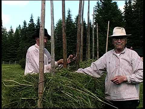 This 45:32 Meänkielen resursbibliotek film was published on 20 November 2023; its title identifies the subject as Hanhivittikko in 2013. The Swedish-language resource page describes traditional haymaking, making a sauna whisk and Tornedalen history, in Meänkieli and Swedish. Hanhivittikko is a separate rural heritage site in the wider municipality, not a venue in the town centre. Treat the upload date and the period named in its title as distinct.
 Europe Video Productions published this 1:17 film on 11 March 2025. Its verified title describes the seasonal Arctic Circle ice road between Juoksenki in Finland and Juoksengi in Sweden; the latter is a village in Övertorneå Municipality, not the central locality. This is a short record of a specific winter route, not current access information or ice-safety advice. Never infer that an ice road is open from the video.