Woimbey sits in the Meuse valley between Saint-Mihiel and Verdun, a small commune whose best-known visitor stop is an active educational farm on the slope above the river. Its appeal is practical and close to the ground: farm animals, outdoor learning spaces and a rural view, with the Meuse cycling itinerary threading through the surrounding villages. This is a place to visit for a particular activity or as a slow stop on a longer route, rather than for a crowded monument circuit.
Population and local scale
Insee counted 133 residents in Woimbey at the 2023 population census. The figure applies to commune 55584 and uses municipal geography in force on 1 January 2026; it does not describe the larger community of communes. Density was 8.7 residents per square kilometre and there were 52 households. The commune belongs to the Saint-Mihiel living area, according to Insee’s geographic classification, while the Meuse river valley connects it to nearby villages and the wider road and cycling network. That combination explains the village’s quiet residential scale and why visitors should plan for services and transport beyond the commune itself.
What the historical record can say
Woimbey’s deeper past is better approached through archival and research records than through unverified local lore. The departmental archives’ finding aids list land leases, a survey of a meadow, exchanges of property and records of rights attached to Woimbey; the abbey fonds include documents linked to the place across the medieval and early modern centuries. A University of Lorraine research entry on the former château and settlement proposes that an earlier village called Mont-Saint-Rémy may have disappeared during the Hundred Years’ War, after which the church moved closer to a castle built in the fifteenth century by the bishop of Verdun. The same entry says Louis XIV ordered the castle destroyed and that the place-name “l’Enclos du château” preserves its memory. The wording is interpretive, and it does not promise visible castle ruins today; it is distinct from legend and should be read as a research summary rather than a complete primary-source transcription.
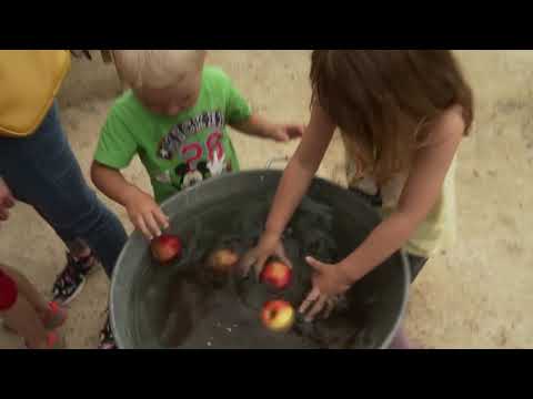
A more recent, directly documented chapter is the Ferme de Woimbey. Its own educational association says schools have used the site since 1990. The present visitor offer grew around that purpose: the farm describes four hectares of park and woodland, animal enclosures and several activity areas, including the Grange aux Expériences, the Verger des Mille Fleurs, the Petit-Bois Tranquille and Ferme enVie. The farm’s description lists about 150 animals and a mix of indoor and outdoor activities. It is a working visitor attraction, not a claim that the commune’s wider economy is based on farming alone.
Work, services and access
Insee recorded 14 jobs located in the commune in 2023 and three employer establishments at the end of 2024. One third of those establishments were in agriculture, forestry and fishing; two thirds were in public administration, education, health or social care. With only three establishments in the measure, those percentages are a narrow snapshot, not a complete account of household livelihoods or non-employer activity. The educational farm adds a distinct visitor and learning service: family visits, school groups and programmed activities, with dates and seasonal hours published by the operator.
The mairie is at 11 rue Haute. The national public directory lists a Thursday reception period, while the intercommunal directory gives a different time span; call ahead rather than relying on either listing. The accessibility entry for the farm says there is no nearby public transport, but parking, adapted toilets and a ground-level entrance are recorded; it also notes a long, gentle slope on the outdoor approach. Contact the farm about current opening, weather arrangements and access needs before travelling.
By bike through the valley
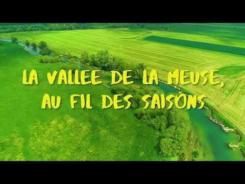
The local tourism office’s “La Meuse à Vélo” guide names Woimbey on the route between Saint-Mihiel and Verdun, with nearby Bannoncourt and Bouquemont among the successive villages. The itinerary combines small roads and river-valley stops; the guide’s stage description is regional rather than a turn-by-turn track for the village, so download current mapping and check road conditions before setting off. The farm is a natural family detour for those making a planned visit, but it is a separate attraction with its own seasonal calendar. Confirm route updates, farm hours and municipal services before departure.