
Vänersborg sits where the southern shore of Lake Vänern meets the route toward the Göta älv and the sea. The water is not just a view from the promenade: it explains why a town grew here, why its economy once relied on moving iron and grain, and why the present centre feels unusually open. Statistics Sweden counted 24,731 people in the mapped built-up locality, or tätort, on 31 December 2023. That figure belongs to the urban-area boundary, not the whole municipality, which also includes smaller settlements and countryside.
Before the town, a market at Brätte
South of today’s centre lay Brätte, a market and harbour place used to transfer goods between the lake and land routes. Vänersborg’s municipal history places references to its harbour in 1531 and to the market in 1550; Brätte is named in the cathedral chapter’s accounts in 1556. The same local account cautions that a first surviving mention is not the same as a founding date and says the marketplace was older than the written record. In the sixteenth and seventeenth centuries, iron from Värmland came across Vänern and then travelled by horse and cart around the unnavigable falls of the Göta älv. That trade gave the location practical weight, not merely a strategic one.
The new town was laid out on Huvudnäsön. Its first houses were built in 1643, and the charter signed by Queen Christina’s regents on 1 February 1644 established Vänersborg as a town. In 1679 it became the seat of Älvsborg County. Brinkebergskulle lock, opened in 1752, helped boats pass the difference in water level between Vänern and the river; when Trollhätte Canal was completed in 1800, shipping gained a direct connection to Gothenburg and the western sea. The municipality’s records document these dates. Stories attached to old Brätte and to the town’s name belong to local interpretation and tradition, not to the same category of evidence.
A centre rebuilt after fire
On 4 October 1834 a major fire destroyed almost the entire town. The municipal timeline lists the church, residence, jail, Crown bakery and eighteen small houses among the survivors, and estimates that roughly two thousand of the town’s 2,100 residents lost their homes. The rebuilding kept the seventeenth-century grid but made room for wider green firebreaks. Today’s Kulturaxeln, including Plantaget, links the residence, central square, church and museum; the broad planted streets Edsgatan and Vallgatan were part of the same fire-conscious plan. It is a civic composition rather than a single monument: walk it slowly and the open spaces, public buildings and surrounding blocks explain one another.
At the eastern end, Vänersborgs museum places the city’s story beside collections gathered from many parts of the world. Its displays include objects from Egypt, African birds, Nordic animals, European art and changing exhibitions, while the museum presents nineteenth-century ideas about travel, nature and culture. The building is described by the museum and municipality as Sweden’s oldest preserved museum environment. Check its current visitor information before setting out; opening days, admission details and special events can change.
Waterfront, woods and ways to explore
Skräckleparken, also called Skräcklan, gives the centre a public edge against Vänern, with a park, playground, bathing beach and a café that is seasonal. Farther north, the Dalbobergen nature reserve follows the shore toward Ursand. The marked Dalbobergen Runt is a verified 7.5-kilometre moderate walk, usually estimated at one and a half to two hours. Its natural and gravel paths include uneven sections; the route is marked blue and white. Dalbostigen offers shorter shoreline access through the reserve, with views over the lake toward Vänersnäs and the twin profiles of Halleberg and Hunneberg. Stay on marked routes and follow reserve rules; surfaces and access can vary with weather.
For a shorter visit, the open centre, waterfront and museum make a natural loop. For a longer stay, the nearby plateau mountains and Trollhättan add distinct day-trip landscapes and canal history. Local shops, cafés, restaurants and municipal services cluster around the central streets. The visitor office at Kungsgatan 9, by the square, can help with maps, accommodation and local suggestions. Trains and buses meet at Vänersborg Resecentrum; check Västtrafik for the departure that fits your day rather than relying on a fixed timetable. Confirm museum hours, café season, event dates and transport schedules before travelling.
 Vänersborg in three films: a winter walk, the old fortress and Dalbobergen
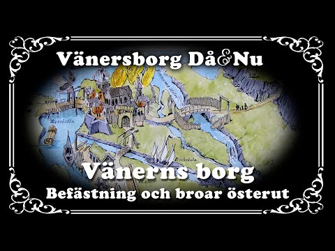 The municipal short ‘Vänersborg Då & Nu - Vänerns borg - befästning och broar österut’ takes a narrower historical angle. Vänersborgs kommun credits historian Lave Thorell with explaining the lakeside fortress and the eastern crossings needed to move people and supplies across the Göta älv’s rapids. The 7-minute, 13-second film was uploaded on 5 June 2024 and belongs to the municipality’s series on local places and objects. It is a useful companion to a walk along the town’s formal historic axis, while its account should be read alongside the documented town chronology.
 ‘Dalbobergen, Vänersborg’ was uploaded by Simon Traskar on 19 June 2026 and runs for 12 minutes, 57 seconds. Its description identifies the Dalbobergen Runt route as roughly 7.5 kilometres and characterises the outing through lake views and wooded, uneven ground. That distance and moderate grading match the destination organisation’s current trail facts. This makes the film a practical preview of the landscape beyond the centre, but not a substitute for checking trail conditions, markings and reserve rules before setting off.