
Ulricehamn is a small town with an unusually clear relationship between its old commercial street and the lake beside it. The centre stands at the northern end of Åsunden, with Storgatan bending through the older town and the water opening out just below. SCB counted 11,794 residents in the statistical built-up locality, or tätort, on 31 December 2023. That figure describes the mapped urban area, not the much larger municipality. It is a useful distinction in a region where a town centre and surrounding villages share the same municipal name.
From Bogesund to Ulricehamn
The settlement was known as Bogesund before it took its present name in 1741. The municipality dates the first written mention of Bogesund to 1307, in the medieval Erikskrönikan. A royal letter in the 1320s suggests that the place could accommodate a substantial travelling household; a 1385 deed mentions a saddlemaker, a reminder that trade and skilled craft belonged to its early urban life. The curved line of Storgatan still helps explain why the town took shape here: it follows the historic route through the settlement rather than a later, straight planned avenue.
The best-known event in the local historical timeline is the battle at Skottek on the ice of Åsunden on 19 January 1520. The municipality’s account says the Danish forces defeated the army gathered by regent Sten Sture the Younger, who was mortally wounded by a cannonball and died two weeks later. The fight is documented in the town’s historical record; the figures and stories that grew around it should be read as later remembrance. The municipality itself separates dated events from a collection of dramatized tales, including the story titled “Bogesunds kloka gumma.” The wooden-and-metal equestrian sculpture Sten Sture till häst, inaugurated in 1973, is a modern memorial rather than a surviving medieval object.
Reading the town on foot
A short walk links the lake edge to the older street. One of the municipality’s marked 3.7-kilometre loops begins on the waterfront below the bus station, follows the shore of Åsunden, rounds the boathouse by the local boat club and returns through central Storgatan. You can shorten the outing by turning back at the water or staying in the centre. The older town was repeatedly damaged by fire. After the great fire of 1788 destroyed twelve farms and the old town hall, the present Rådhuset was built in 1789–90; it also housed a school until 1914. Ekeskogs bookshop, in business since 1875, gives the street a rare continuity of use. The church retains medieval elements, while the municipality’s heritage inventory identifies the station building, locomotive water-filling equipment and a bridge over the Ätran as traces of the railway era.
That rail story is also part of the landscape rather than only a set of buildings. The municipality’s first railway to Vartofta opened in 1874. Former railway embankments have since become part of a 70-kilometre paved, car-free cycling route across the municipality. South of town the ride stays by Åsunden; northward it enters the long-settled Ätran valley. For a first visit, the waterside loop and the old street make an easier introduction than trying to cover the full route in a day.
Lake, woods and a sporting town
At the northern end of the lake, Sturebadet offers lawns, two piers, a small sandy edge, toilets and a bathing ramp. Ulricaparken is beside it, and the bus station, cafés and restaurants are nearby. The setting works as a simple place to pause even when you are not swimming. Water quality and algae conditions are tested and can change through the season, so check the current notice before entering the lake. The town’s public art adds another layer: the municipal catalogue records sculptures and murals that revisit local people, landscapes and historical episodes, including a mural inspired by the Sten Sture story.
Beyond the centre, Lassalyckan and Sanatorieskogen make a distinct half-day visit. Municipal maps list marked 3.5-, 5-, 10- and 15-kilometre walking and running tracks, plus mountain-bike routes and a multi-sport path. The site is also known for cross-country skiing, and the municipality’s timeline records its first World Cup event in 2017. Snow and course access are seasonal, and cycling or walking routes can cross one another, so check the latest local track information and signs before setting off.
Work, services and getting around
Ulricehamn is more than a lakeside stop: its centre has shops, places to eat, municipal services and visitor information. The municipality’s business profile describes the wider local economy as a mix of small and medium-sized firms, with manufacturing, construction, retail, agriculture and forestry, business services and tourism among its principal sectors; these are municipal, not tätort-only figures. The visitor desk is in the town hall beside Stora torget and provides local maps and event information, though opening arrangements should be checked before relying on an in-person visit. Regional buses use the central bus station; consult Västtrafik’s live journey planner for the day and connection you need. The town lies on the Riksväg 40 corridor between Borås and Jönköping, but roadworks and travel times vary.
Ulricehamn rewards a measured visit: spend time with the street plan, take the signed lakeside loop, then choose either a swim or an outing to the forest trails. Opening times, water conditions, bus departures and sports facilities are time-sensitive; confirm them with the responsible operator before travelling.
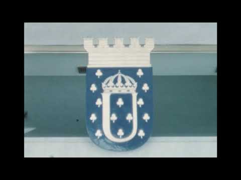 Ulricehamn in three films: old Bogesund, a visitor’s invitation and a youth-made city song
 The 20-second ‘Besök Ulricehamn en del av Västsverige’ was uploaded by Helena Haglund on 27 March 2015. Its description is a compact invitation to explore the area through activities, events, food, shopping and bathing or spa. It is useful as a quick introduction to the destination’s visitor-facing themes, while its age means that no current opening time or service should be inferred from it.
 Ulricehamns kommun uploaded ‘(G)ung i Ulricehamn - 2023 års feriefilm’ on 18 December 2023. At 5 minutes and 19 seconds, it is the longest of the municipality’s youth summer-job films identified on the page. The description says young seasonal employees made a song and accompanying music video about their town from a youth perspective. It offers a community-made view of local identity rather than a practical guide to attractions or schedules.