Taipalsaari is an archipelago municipality in South Karelia, just north of Lappeenranta and threaded through by Lake Saimaa. Statistics Finland counted 4,574 residents across the municipality on 31 December 2025. The inhabited landscape is divided among several villages, while summer cottages and seasonal visitors add another rhythm to the shoreline. Municipal visitor information describes roughly 700 islands and about 1,000 kilometres of coastline; the precise figure depends on how the many bays and inlets are measured, but it conveys why water shapes nearly every local route.
Village life across a lake landscape
Taipalsaari is not one compact lakeside resort. Kirkonkylä holds the church and historic centre, while Saimaanharju and other settlements provide homes, schools, recreation and services. The municipality sits around 15 kilometres north of Lappeenranta, close enough for regular regional travel but with a distinct village and island character. Local visitor listings include accommodation in cottages and farm settings, cafés and food services, shops, guided activities, marinas and rental services. There are also beaches, trails, sports grounds and indoor facilities for residents. Opening dates and availability vary, so a visitor should check the current local directory rather than assume every service is open year-round.
Water transport once mattered as much as roads. Between the late nineteenth century and the mid-twentieth century, municipal history identifies lake shipping and boatbuilding among the area’s important sources of work. Today the shoreline supports recreation and tourism, while many residents use Lappeenranta for work and larger services. That mix of daily commuting, local services and seasonal stays helps explain why Taipalsaari feels both connected and dispersed.
A church village with layers of history
The Kirkonkylä–Saimaanharju heritage route brings together traces from different periods: Stone Age settlement areas, the Iron Age hillfort of Kuivaketvele, the parish centre that developed from the sixteenth century, the wooden church, old granary and Röytty. In 1571, the Taipale administrative parish was made into a separate parish called Taipalsaari. The village grew on a narrow strip between waterways, at a meeting point of water, winter-ice and road routes. The municipality’s history describes this as a regional administrative and church centre, not as evidence for an invented ancient city.
Taipalsaari’s wooden church was completed in 1754 and is described by the local parish as the oldest surviving church building in South Karelia. The belfry dates from 1750. The church was enlarged and substantially altered in 1846–47, so the building visitors see carries more than one architectural phase. Its designer is not known with certainty; the parish says it is believed to have been Eskil Collenius. The nearby Röytty heritage house adds a different view of travel and authority. First mentioned as an officers’ residence in 1680, it later became an inn on land and water routes. The restored house, outbuildings and granary now form the local-history museum; its café and craft shop operate mainly in summer and at holiday times.
Hillforts, shores and island routes
Kuivaketvele hillfort rises steeply above Saimaa and is among South Karelia’s most striking ancient fortified sites. Archaeological research has identified a substantial earth and stone rampart on the gentler approach. The site belongs to a broader local landscape of hillforts, prehistoric settlement places and rock art elsewhere in Taipalsaari. The evidence supports a story of people choosing defensible, water-linked places; it does not establish every traditional explanation for why each site was used. Some approaches are steep and rocky, so check access guidance and wear suitable footwear.
Nature visitors can choose between shore walks, beaches, boating, paddling and cycling. The Saimaa Archipelago Route passes through Taipalsaari and connects rural villages with the larger towns of the region; its cycling sections include long lake views and services around Saimaanharju and Kirkonkylä. The municipality also lists several Saimaa Geopark natural and cultural sites. Kyläniemi and Jänkäsalo have ferry connections, but schedules and operating arrangements differ. Those crossings can be part of the journey, not a detail to leave until the last minute.
Getting there and planning well
From Lappeenranta, Taipalsaari is a short regional journey by road, bicycle or bus. Municipal information says Toimi Vento operates weekday route service during the school year, while another operator covers evenings and weekends. Services and timetables can change with the season. A car or bicycle gives more flexibility for reaching heritage sites and shore areas outside the main settlements. Before setting out, check bus times, ferry operations, museum and church access, trail conditions and seasonal business hours. A rewarding first day can combine the church, Röytty and a shoreline route; a longer stay can follow the archipelago toward Sarviniemi or the ferry-served islands.
 Three Taipalsaari videos: Saimaa bikepacking and local ospreys
 The title identifies a 2025 osprey ringing event in Taipalsaari, and the municipality’s own account confirms that local osprey nesting is followed through the season. This is a different perspective from a nest camera: it points to field monitoring and the care used to identify birds, without this review inferring procedures or details that are not confirmed by the title. It adds a concrete nature subject to a visit built around lakes, heritage and outdoor routes.
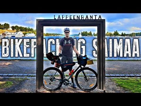 Taival Outdoors follows the Saimaa Archipelago Route across three days and names Taipalsaari in its route description. The published chapter list includes the Sarviniemi bike ferry and a later return through Taipalsaari, making this the most practical of the three clips for understanding a cycling itinerary. The journey continues through several municipalities, so not every scene belongs to Taipalsaari. Verify current ferry timetables, route conditions and services before using the video to plan a trip.