Miehikkälä is a dispersed rural municipality in Finland’s southeastern corner, where the road from the Gulf of Finland meets a landscape of forests, fields, rivers and small villages. Statistics Finland counted 1,664 residents in the whole municipality on 31 December 2025; the figure is not a count for the central village alone. There is no single monument that explains the place. Its character comes from several layers: an agricultural parish shaped by changing land ownership, industries that used local water and timber, and the concrete remains of a vast wartime defence line.
A parish, a municipality and a complicated land history
The parish separated from Virolahti in 1863, while the municipality itself was established in 1887. Those dates mark different steps in local self-government. Earlier, parts of present-day Miehikkälä belonged to donation lands granted by Empress Catherine II to Major Matvei Olsujev in 1790. The municipal account says the grant included farms in Miehikkälä, Kylmälä, Säkäjärvi and Tiilikkala. For generations, farmers worked land they did not own and owed labour and produce to its holders. The donation-land period ended in 1877, when the state redeemed the holdings and transferred them to farmers. This history gives the quiet village roads a social story as well as a rural appearance.
Industry also left a more surprising mark. Kalliokoski glassworks opened in 1861 and operated, with interruptions after fires and changes of ownership, until 1931. It made window glass and employed specialist workers as well as people from nearby farms in transport and other work. Its rise and closure followed changes in the wider glass industry; the former factory is a historical site, not a guaranteed open museum. In later decades, sawmills, flour mills and small power stations used the rivers. Today the municipality describes a mix of service businesses and small-scale processing of wood and stone, alongside farming and visitor services.
Walking through the Salpa Line
Miehikkälä’s most visible visitor attraction is the Salpalinja Museum, an outdoor museum on rugged, fortified ground. Its focus is not simply weapons: the museum tells how the eastern land-defence line was planned and built, and what that work meant for the thousands of people who constructed and supplied it. Suomen Salpa was built in 1940–41 and again in 1944, after the Winter War and during the later wartime period. The roughly 1,200-kilometre system ran from the Gulf coast northward. It was never fought on, so it should be understood as an immense defensive construction and a record of Finland’s wartime preparations, rather than as the site of a battle victory.
The shared Salpapolku trail follows the line through Miehikkälä and neighbouring Virolahti toward Hostikka cave. The official route is about 50 kilometres, but it can be walked in shorter sections and is also used by mountain bikers. A separate Salpalinja cycling loop is longer and is not marked on the terrain, so download its current route before starting. Around Hauhia, a listed guided loop of about 6.3 kilometres combines river scenery with nearby fortifications. Ground conditions, access and services vary by season; check with the museum or local visitor service, and keep to safe public paths around old structures.
Church, mill and village art
In the central village, the church is a good counterpoint to the military landscape. Designed by Lindqvist, it was begun in 1879 and consecrated in 1881 after being built largely through local volunteer work. The altarpiece, painted by Väinö Hämäläinen in 1930, and the nearby memorial cemetery connect the building to both parish life and the losses of the wars.
At Hauhiankoski, the old watermill tells a different story of work and community. Municipal sources describe the building as dating from 1882 and say the mill was completed in December 1881; the two dates refer to different descriptions and are best kept together. A sawmill and later a generator were added. The site is now associated with local events and the sculptures of self-taught artist Sylvi Hauhia, whose figures of people and animals fill the mill yard and gallery. Visitors should respect the residents’ privacy: some works stand outdoors by the road, while access to the private yard depends on the owners being present. Further village stops include the former Suur-Miehikkälä mill landscape and the Syväjärvi and Halmaanjärvi swimming areas.
Getting around and making a visit work
Miehikkälä is 40 kilometres from Hamina, 65 from Lappeenranta, 90 from Kouvola and 15 from Vaalimaa, according to municipal location information. The E18 corridor provides the main regional road connection, with local roads leading to the villages and museum sites. Public buses are listed on the Miehikkälä–Hamina and Taavetti–Lappeenranta corridors, but rural services are limited and timetables change; confirm the exact stop and travel day with the operator or Matkahuolto before setting out. A car or a planned cycling trip makes it easier to link the museum, church, Hauhia mill and village routes.
The visitor portal lists accommodation, guided activities, bicycle rentals, cafés and food services, but many are seasonal or require advance booking. The museum café operates with museum opening hours, and a village shop or service may be some distance from a trailhead. A rewarding day is to begin at the museum, walk one section of the Salpapolku, then continue to the mill and church, leaving time for a swim or a village detour. Check opening hours, trail conditions, transport and bookings shortly before travel.
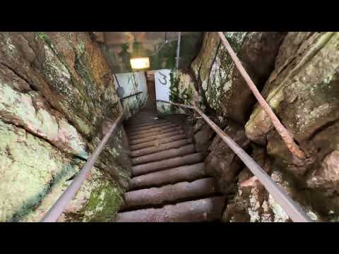 Miehikkälä en tres videos: Salpalinja, Salpapolku y Hauhia
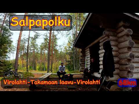 Ksdadventure documents a personal mountain-bike outing from the Virolahti Bunker Museum toward the Takamaa shelter and back, describing a 68-kilometre day that passes through the Miehikkälä area. The extended ride shows how Salpa Line sites and forest tracks fit into one ambitious trip. That distance belongs to this creator’s itinerary, not the official length of Salpapolku; check the current route map, terrain and daylight before attempting anything similar.
 This 55-second clip turns briefly to Hauhian mill at Hauhiankoski, with the river setting and Sylvi Hauhia’s sculpture in the surrounding area. The accompanying description also mentions Salpa Line nearby and a 2026 local event. For the mill’s date, municipal pages distinguish an 1882 building from a mill completed in December 1881; the video itself says 1881. Treat it as a short visual introduction and confirm access, privacy and opening arrangements locally.