A municipality shaped by water and connection
Sottunga is the smallest municipality in Finland by population, but its story is larger than the number suggests. ÅSUB counted 101 residents in the whole municipality on 31 December 2025. The figure includes the main island and the surrounding inhabited islands; it is not a count of Sottunga village alone. Swedish is the language of municipal life and the local visitor sources, and the landscape is best understood as an inhabited archipelago rather than one compact settlement.
The main village sits about three kilometres from the ferry harbour. Its farms and houses occupy a landscape changed by post-glacial land uplift: a strait that once ran through the island gradually disappeared, leaving the settlements now called Norra byn and Södra byn on either side of land that used to be water. A marked village walk follows that older settlement ground. Open fields, old farmyards, wooded ridges and sea views make the small scale legible on foot, while the ferries place Sottunga in a wider chain of islands between mainland Åland and the Turku archipelago.
What the records say, and what remains tradition
Sottunga's municipal history estimates that permanent settlement began around the 11th century. The estimate comes from comparing place names with the shoreline of earlier centuries, reconstructed through land uplift. It is an informed historical interpretation, not a surviving record naming a founder or a precise year. The same local account suggests the name may be older than settlement and may have been carried by the first inhabitants.
The chapel is documented more securely. A chapel on Sottunga appears in a 1544 record connected with Gustav Vasa's confiscations, when a copper bell was taken. Local tradition places that first chapel on Kapellön, about a kilometre from the present church, but the location is not established as fact. The present red wooden chapel, Maria Magdalena, was completed around 1730 after the earlier chapel burned in 1726, according to the parish history. Its short, high form and shingled roof stand beside the harbour road. Inside, a votive ship carries a more romantic story: tradition says a sailor from Kökar promised to build model ships for both islands if he survived captivity by pirates in North Africa. The story belongs to local memory, not to the documented construction history.
The village itself rewards a slow walk. The route passes farmyards with preserved outbuildings and mature ash, maple and oak trees, the former rectory of 1899, and the old school whose oldest section dates to 1903. The school building now serves as a local-history museum and exhibition space. A single mill remains from the roughly ten windmills recorded in the village during the nineteenth century. These details make Sottunga's history tangible without turning it into a reconstructed set: the working landscape and the heritage buildings remain part of the same small community.
From subsistence farming to a visitor economy
The municipal history describes older agriculture as modest and mainly intended to feed households. Hunting and fishing supplied food and income: seal hunting was once important, spring bird hunting helped replenish meat after winter, and herring fisheries supported both trade and smoking works. The methods changed over time, from nets and shore seines to winter seine fishing in the 1940s and 1950s, when catches could be shipped fresh to Turku. The local account says fishing later contracted to household use.
A 2024 island profile, based on interviews with the municipal secretary in 2021, describes a later economy centred on municipal services and tourism, alongside small-scale farming. At that time the account identified one dairy farmer and one vegetable grower. These are dated observations, not a current business census, but they help explain why a harbour, shop and public services matter so much here. Tourism grew through projects that improved the guest harbour and marked the St Olav Waterway, a long-distance pilgrimage route linking the Åland archipelago with routes toward Turku and Trondheim.
Walks, church, harbour and a summer stay
There is more than one way to explore the island. The village walk, about 1.6 kilometres according to its detailed route description, is the easiest introduction to the old settlement, farmyards, museum and midsummer pole. The 4-kilometre Skogsrundan leaves the harbour area, passes the chapel, crosses pine forest and rocky ground, and returns beside a wetland and the village road. Its ridges open westward over the archipelago; exposed rock can be slippery after rain. A separate St Olav Waterway section is listed at about 8.5 kilometres from the ferry harbour, through the western hills and Söderbyn before following the road back. Check current waymarking and trail conditions locally, since listings describe different routes and distances.
The guest harbour occupies a former salt house beside the ferry landing. Its visitor listing describes the Salteriet restaurant and café, showers, toilets, sauna, a bathing platform, bicycle access and an 18-hole disc-golf course beginning near the harbour. The listed harbour season runs from early June into September, but services and dates can change. Strandhugget B&B is another accommodation option by the harbour; reserve directly and confirm what is open. In the village, a cooperative shop, postal agent and library provide everyday services on an unusually small scale. Check opening hours before planning around them, and confirm access with the parish if you want to see the chapel, which may be closed during winter.
Getting there and planning a route
From Mariehamn, travel by road across Åland to Långnäs in Lumparland and continue by the southern archipelago ferry to Sottunga. From the Finnish archipelago, Galtby in Pargas connects by ferry through Kökar. The route also serves places such as Överö in Föglö; some intermediate calls require advance arrangements, and some journeys involve a change of vessel. For a longer itinerary, Sottunga can be combined with Kökar or Föglö, but the ferry plan should shape the day rather than be treated like an urban transit connection. Check the current Ålandstrafiken timetable, booking rules, seasonal variations and any traffic notices before travelling.
Sottunga suits visitors who want to understand how a community works between sea crossings, not simply collect a viewpoint. A walk from harbour to village links the chapel, museum, farm landscape and public services; a second day can add the longer trail, a boat excursion or time for the local harbour. Leave room for weather and the ferry schedule. That unhurried scale is part of what the island offers: a living rural place whose history is visible in its shoreline, working farms, small institutions and the routes that still connect it to neighbouring islands.
 Sottunga in three films: pilgrimage, small harbours and an island outing
 The PortMate project’s 2019 film presents small ports and surrounding scenery in Sottunga and Kökar. Its description says the aerial footage was filmed in summer 2018 as part of a project on safer, more resource-efficient harbours. It offers a harbour-focused perspective, but its footage predates today’s services and should not be used as a current facilities list.
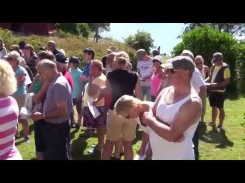 Petter Rönnlöf’s 2014 recording follows a Sottunga residents’ outing to Södö, where Björn Rönnlöf tells stories about the island. That local excursion gives the film a community-history angle distinct from the pilgrimage walk and harbour project. It is a record of a specific outing, not evidence of a regularly available visitor tour.