A municipality spread across water and villages
Larsmo is best understood from the shore or the road that crosses its islands. The municipality counts about 365 islands, islets and skerries, and its shoreline stretches for roughly 500 kilometres. The largest islands are Larsmo and Eugmo; Holm, Risö, Eugmo and Bosund are among its main centres. The Seven Bridges Road, regional road 749, links this scattered geography with the mainland. Statistics Finland’s municipal figures record 5,955 residents on 31 December 2025. Larsmo is bilingual, though Swedish is overwhelmingly the main local language: 91.6% of residents were Swedish speakers and 4.9% Finnish speakers in the 2025 statistics.
The figures also show a young population: 29.8% were under 15 at the end of 2025. That helps explain why Larsmo feels like a living residential municipality as much as a summer destination. Its attractions are distributed among fishing villages, woodland trails, marinas and small islands, so a visit benefits from a car, bicycle or boat rather than a single walking itinerary.
From chapel parish to modern island community
Larsmo’s municipal history begins in 1867. The municipality’s own historical account distinguishes that date from the chapel parish founded in 1787 and the first meeting of municipal government in 1869. The settlement’s older identity grew in a working archipelago where water shaped travel, food and craft. Fishing, seal hunting, farming and boatbuilding were once central livelihoods. The municipality says fishing and agriculture later declined in relative importance as small industry and services grew; many residents now commute to neighboring towns, while boatbuilding remains a defining local industry.
That continuity is visible in the municipal coat of arms, which depicts a two-masted fishing boat. It is also tangible in Bosund, long associated with boat construction. The municipality names Baltic Yachts and Bella Boats among local firms; this industrial activity sits alongside the region’s older craft tradition rather than replacing it. The Bosund Boat, Fishing and Hunting Museum makes that relationship unusually clear: its collection includes about 55 clinker-built wooden boats, boat engines, fishing gear and seal-hunting equipment, displayed among boathouses, net sheds, a salt storehouse and an archipelago forge. Opening is seasonal and largely volunteer-run, so check the museum’s current hours before travelling.
Churches, fishing places and island stories
Larsmo’s wooden cross-shaped church is a prominent landmark. Municipal heritage planning dates it to 1785–1789 and associates the design and construction with Jacob Rijf. Its scale and setting reflect the old chapel parish; the church’s date should not be confused with the later formation of the municipality. Nearby and farther north, local-history collections provide a different kind of architecture: boatsheds, smokehouses and modest cabins built for work rather than display.
At Bosund, the maritime museum gathers vessels and equipment that once served everyday fishing, travel and hunting. Bjärgas local-history museum broadens the picture with displays on household life, school, textiles, toys, local trade, technology, fishing and seal hunting. Together they show how island life depended on skills carried between generations, and how objects built for work can also tell the history of a community.
Several sites are reached by water. Olofsborg on Olasören is a restored old fishing settlement with a 16-metre observation tower, smoke ovens and public grills; the municipal visitor guide says overnight stays are free. On the outer island of Öuran, an old fishing camp and trails begin near a renovated ice cellar. Guided walks, boat transport and meals can be arranged. These are not road-side attractions: plan boat access and confirm seasonal arrangements.
Köpmanholmen is the municipality’s summer recreation island. From Sonamo harbour, visitors can cross in their own boat or use municipal rowing boats; a free taxi boat runs during public opening hours. The island has a summer restaurant, sauna, swimming beach, jetties, an observation tower and a conference space. Its service calendar is seasonal, so check current opening dates before building a day around it.
Walking, cycling and the coast
The Larsmo Trail connects outdoor routes around Holm, Eugmo and Bosund, with the wider network extending to about 44 kilometres. Individual walks range from one to fourteen kilometres. The routes were designed for snow-free seasons and are not maintained for winter walking; forestry operations may occasionally affect access. Around Holm, visitors can choose an eight- or thirteen-kilometre route, while Eugmo has nine- and twelve-kilometre options. The municipality and local associations share maintenance, and trail shelters, rest places and boardwalks make the paths more accessible in wet sections.
Regional road 749 has a cycle path running through the municipality, giving cyclists a practical way to move between centres. The same road is the natural scenic approach from Jakobstad to the south or Kokkola to the north. Along the coast, the M/S John Grafton monument on Orrskär recalls a specific event in 1905: the arms ship ran aground offshore and was blown up so that Russian authorities would not find it. It is a documented wartime episode, not a legend of an ancient wreck.
Work, services and getting there
Visitors will find the strongest services at Holm and the larger village centres, with shops, public facilities, sports areas, harbours and seasonal visitor services spread across the municipality. The local economy is a mix of industry, boatbuilding, services and commuting, while the archipelago remains a setting for fishing, boating and outdoor recreation. Plan for modest, locally run hospitality: island restaurants and museums can close outside the summer season, and boat trips often need advance arrangements.
The nearest railway station is Bennäs, also called Jakobstad-Pedersöre, about 20 kilometres from Larsmo. A bus connection links it with Jakobstad’s bus station; verify that connection against the train you choose. Kokkola-Jakobstad Airport is in Kronoby, around 30 kilometres away. Regional buses and tickets can be checked with Matkahuolto or Ingsva, but schedules vary. By car, follow regional road 749 and the Seven Bridges Road; by bicycle, use the path that parallels it. Jakobstad and Kokkola are natural gateways, while Larsmo itself is best explored in stages: start with Bosund’s boatbuilding heritage, then set aside time for Köpmanholmen or the outer archipelago.
 Larsmo in three films: boatbuilding, fishing camps and island farming
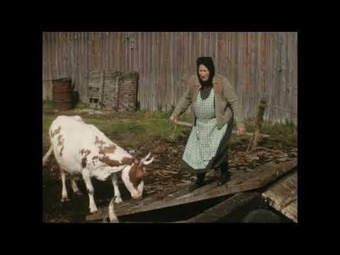 This 1957 archive film follows the seasonal movement of livestock and household goods from Larsmo to island pasture. Its catalogue description records cows, calves, a bull and horses being led to boats and towed to the islands, with a map and views of buildings on the grazing islands. The film documents a specific working routine and should be read as archival evidence, not a reconstruction of present-day farming.
 Svenska litteratursällskapet’s 1957 film documents Larsmo fishing settlements. The archive identifies it as a record of fishing places; its catalogue describes cabins, boathouses, nets and coastal work. The short archival view complements the boatbuilding film by showing the places and routines around the vessels. It is valuable as historical documentation, while the municipality’s current visitor pages provide access information for surviving sites.