Kirkkonummi sits just west of Helsinki, but the municipality feels larger and more varied than a commuter stop. Its railway-side centre, wooded inland lakes, old farm landscapes and long Gulf of Finland shoreline all belong to the same municipality. Kirkkonummi had 41,873 residents on 31 December 2025. Finnish was the registered mother tongue of 71.9 per cent of residents and Swedish of 14.4 per cent; the municipality is officially bilingual, and its Swedish name is Kyrkslätt. That living bilingualism is part of the place, alongside a landscape shaped by transport, agriculture, villas and one of Finland’s most consequential post-war border changes.
A medieval parish between two coasts of history
The municipality’s first known written mention is in a Latin document dated 21 March 1330. Kirkkonummi’s grey-stone church, dedicated to St Michael, is the oldest surviving building in the area. It was completed no later than the fifteenth century, although the municipality notes that parts may be older, perhaps from the thirteenth century. That distinction matters: the church is securely medieval, while an earlier date for some sections remains a possibility rather than a settled fact. The historic King’s Road between Turku and Vyborg also crosses the municipality, linking the parish to a wider network of travel and trade.
For centuries the district was rural, with settlements spread between fields, woodland and the sea. In the late nineteenth century, steamboat traffic from Helsinki helped create villa communities in Luoma, Masala and the archipelago. The best-known example is Hvitträsk, completed in 1903 as the home and studio of architects Eliel Saarinen, Herman Gesellius and Armas Lindgren. The railway line later strengthened settlements such as Masala, Luoma and Jorvas. Faster transport widened markets for agricultural and horticultural produce and helped small industry grow. Hvitträsk is now a National Museum of Finland summer museum; its 2026 season has ended, and the current visitor notice gives 1 May 2027 as the next scheduled opening. The building has many stairs and no lift, so check access information before planning a visit.
Porkkala: a documented rupture, not a founding legend
The event that most sharply changed modern Kirkkonummi began in 1944. Under the armistice, the Soviet Union leased a naval-base area that included two-thirds of Kirkkonummi, almost half of neighbouring Siuntio and all of Degerby. Residents had ten days to leave. The original lease was for fifty years, but the return was agreed in 1955 and the boundary gates opened on 26 January 1956. The abrupt evacuation, years behind a closed boundary and the difficult return left a deep mark on families and the local landscape. In 2026 the municipality marks seventy years since the return.
Some traces remain outdoors: the municipality documents bunkers and military structures from the lease period, including old fortifications around Meiko. They are historical evidence, not an invitation to enter unsafe or restricted sites. The Ragvalds museum area and its Eliasvillan exhibition offer a more appropriate way to understand displacement and everyday life during the lease. Ragvalds is seasonal; its 2026 visitor season ran from 2 June to 29 August, so check the municipality’s current calendar before setting out.
Lake trails and the outer edge of the archipelago
Meiko, northwest of the centre, brings together clear water, rocky ridges, small forest lakes and wetland. Three marked options make it possible to choose a scale: Kuikankierros is 3.2 kilometres, Meikonkierros 8.3 kilometres around the lake, and Kotokierros 4.4 kilometres past several smaller ponds. The area has designated fire sites, dry toilets and a limited overnight spot at Korsolampi. Most trails are not suitable for visitors with reduced mobility; the municipality says the roughly 600-metre gravel access to one fire site is passable with a wheelchair or stroller, but steep. The routes are best treated as outdoor walks requiring suitable footwear and attention to conditions, not as a fully accessible park circuit.
Farther south, Porkkalanniemi opens onto the sea. Its exposed rock shores and pine-covered outcrops make a strong contrast with Meiko’s inland forest. Telegrafberget is noted for sea views, while Pampskatan is a birdwatching point during spring migration. The municipality lists ten cooking shelters and fire sites, toilets and several parking areas across the recreation landscape. Different public and private landholders manage parts of the wider area, so use signed access points, follow fire rules and check any local restrictions. The long shoreline and many islands reward a slower visit; this is a place to watch weather and light, not to hurry between viewpoints.
Getting around and building a visit
Kirkkonummi is about 30 kilometres from central Helsinki. The coastal railway passes through the municipality, and the municipal visitor page gives a journey of roughly half an hour to Helsinki; Kirkkonummi is inside the HSL fare area. Highway 51 follows the southern side of the municipality, E18 crosses the north, and Ring Road III reaches the western edge. Train and bus timetables change, and attractions are spread across a large area, so check HSL before travelling and plan the last leg to trailheads rather than assuming a station is beside them. The National Museum’s directions for Hvitträsk describe trains to Kauklahti, about six kilometres away, with taxi connections and a limited bus-and-walk option on selected weekdays.
A first day can stay near the centre: see the medieval church, then visit Ragvalds or follow the local-history thread that leads to Porkkala. A second outing can focus on one landscape, either Meiko’s lake circuit or the coast at Porkkalanniemi. Architecture-minded visitors can add Hvitträsk when it is open. Espoo borders Kirkkonummi to the east, Siuntio to the west and Vihti to the north, making the municipality a useful base for exploring western Uusimaa. Shops, cafés and municipal services are concentrated around its settled centres, while the best nature sites require a little more preparation. The appeal is precisely that shift: a connected Helsinki-area municipality whose history and scenery open up once you leave the station.
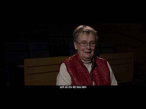 Kirkkonummi in three films: Porkkala, villas and nature
 Episode 6, “Manors and National Romanticism,” turns to the estate and villa culture that grew with transport links around the turn of the twentieth century. It offers a useful cultural counterpart to the municipality’s account of Hvitträsk and the architects who made the atelier home. The episode is a historical documentary, not a current visitor notice; check museum dates and access separately.
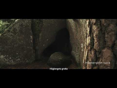 Episode 8 is devoted to nature in Kirkkonummi. It complements the municipality’s practical descriptions of Meiko’s marked lake and pond routes and the more exposed coast at Porkkalanniemi. The film is an introduction to local landscapes rather than a live conditions report, so use current trail information for access, fire rules and seasonal restrictions.