Castiglione del Lago is a lakeside town shaped by two kinds of geography: the broad, shallow waters of Lake Trasimeno and the narrow ridge on which its old centre stands. From the ramparts, the lake opens toward its islands and the hills of Umbria and Tuscany; below, the modern town and its shore spread across a much larger municipal territory. The historic core is compact enough for a slow walk, but the municipality includes many settlements and rural districts. Istat estimated 15,202 resident inhabitants for the whole municipality on 1 January 2026, not for the old centre alone. Italian is the local administration’s written language and is used for this guide’s local-language edition.
A promontory with a long, still-studied past
The town’s position explains its strategic importance better than a romantic foundation legend would. Its ridge looks over a lake basin that connected communities, fields and routes between Umbria and the Val di Chiana. The municipality’s historical account describes an Etruscan settlement founded in the early sixth century BCE by Chiusi, and reports a sanctuary associated with the deity Celati, necropolises and later Roman remains. Those claims belong to the Comune’s account of the archaeological record; they should not be enlarged into a claim that every part of the present town is securely dated to that period. Research continues: in 2026 the Ministry of Culture publicised ongoing excavations carried out with the municipality and an academic team, with finds being studied at Palazzo della Corgna. The work is a reminder that archaeology here is active inquiry, not a finished legend.
In the early Middle Ages the Trasimeno area lay between Lombard and Byzantine spheres. The municipal history associates the ancient acropolis with a church dedicated to Saints James and Philip. After the year 1000, fortifications were repeatedly strengthened to control routes between Rome and Orvieto on one side and Arezzo and Florence on the other. The Comune dates the major surrounding walls to the thirteenth century and connects their construction with Frederick II. Over time the settlement’s name changed; the present one records both its fortified character and its position beside the lake.
The della Corgna plan still shapes the walk
A decisive change came in 1550, when Pope Julius III granted the territory to his sister Jacoma and her sons Ascanio and Fulvio della Corgna. The family held the marquisate and later duchy until 1647. Their residence and urban programme gave the centre much of the orderly appearance visitors notice today: the municipality describes small houses aligned along two principal streets, a pattern that remains legible. The palace was not simply a grand house placed beside an older town. It was part of a reorganisation of the settlement, joining government, display and control of the lake approaches.
The Rocca Medievale, commonly called the Rocca del Leone, occupies the highest end of the ridge. The Comune describes an irregular pentagonal plan, a 39-metre triangular tower and four further towers, two of them round additions from the first half of the sixteenth century, when artillery changed the demands of defence. An older stretch of wall is associated with the Etruscan acropolis, while the ruins of a church dedicated to Saints Philip and James remain inside the fortress. One small but revealing detail in the municipal account is that the name “Rocca del Leone” is not documented in contemporary or later records, although the fortress is now widely known by it. The visit begins through Palazzo della Corgna and continues along the fortified passage; the ramparts reward a pause for the wide view rather than a hurried climb.
Palazzo della Corgna contains frescoed rooms and is the municipality’s principal monument. Its visit is paired with the walk through the Rocca, making the two buildings a single historical itinerary. The municipal visitor information says the museum route through the palace is accessible, while the towers and fortress route have architectural barriers. Admission is paid for non-residents, and seasonal opening schedules can change; confirm current access, ticketing and hours before setting out.
Churches, streets and the shore
From the palace, follow the old centre’s two main streets toward Porta Senese and the lakeside. Santa Maria Maddalena stands on the principal street near that gate; San Domenico and the parish church of Saints Peter and Paul add other stops in the town and its outlying settlements. The point is not to race between monuments. The lanes reveal how the fortified ridge was fitted to a narrow site: doorways and small squares face inward, while the fortress and the lake edge repeatedly pull the view outward. The municipal site also records heritage in places beyond the centre, including Casamaggiore and Pozzuolo Umbro, which reward visitors with a car or an extra day.
At the foot of the ridge, the lungolago offers a gentler counterpoint to the enclosed streets. The shore is the place to slow down, watch the changing light and understand that the lake remains a working environment as well as a view. Fishing and lake commerce are part of the area’s documented past; present-day livelihoods also include commerce, construction, manufacturing and visitor services. A municipal planning document for 2023–25 identifies accommodation and food service as an important part of the local visitor economy. The wider territory belongs to the Colli del Trasimeno wine-growing area; the regional production rules include Castiglione del Lago. Hillside agriculture and lake tourism sit beside the everyday services of a municipality much larger than its postcard centre.
Events and landscapes beyond the walls
The Festa del Tulipano gives the town a distinctive spring identity. Italy’s Central Institute for Intangible Cultural Heritage dates the festival to 1956 and explains that its first edition celebrated tulip cultivation introduced locally in the 1930s. Today local groups build allegorical floats decorated with real petals, choosing a different theme each year. The municipal calendar gives updated dates and admission details; neither the parade nor its arrangements should be assumed to be the same from one spring to the next. Other cultural and sporting events use the Rocca, the lakeside and the former Eleuteri airfield, so the town’s calendar changes with the season.
Castiglione is also a useful base for exploring the Trasimeno shore. A cycling and walking circuit of roughly sixty kilometres follows much of the lake, though some stretches use ordinary roads rather than a fully separated path; check the current map and conditions before planning the complete loop. Nearby Passignano, Tuoro and San Feliciano offer different waterfront perspectives. Isola Polvese, the lake’s largest island, preserves historic buildings and a nature-focused educational park managed by the Province of Perugia. Boats have served it from Castiglione and other piers, but navigation is seasonal and in 2026 the operator announced route changes and suspensions linked to low water. Confirm the current timetable, departure pier and island access with the operator before making the crossing.
How to arrive and plan a visit
Castiglione del Lago has a regional railway station on the route linking Chiusi and Terontola with Perugia and Foligno. From Perugia, regional trains or Busitalia’s E018 bus, which runs through Magione and Macchie toward Castiglione and Pozzuolo, are possible approaches; connections and stop locations vary by service. By car, the SS71 is a principal approach through the Trasimeno area, with the A1 motorway accessible farther west at Chiusi or Valdichiana. Use current timetables and road information rather than relying on an old itinerary. Local urban transport operates too, but schedules are date-specific.
Allow at least half a day for the historic centre and the palace-fortress visit. A fuller day can add the lakefront and one of the nearby villages; a second day makes room for cycling, an island visit or the countryside. The old streets and fortress include slopes, steps and uneven surfaces, so check accessibility and footwear needs in advance. Tourist information and maps are available through the Trasimeno visitor service. For a practical trip, verify the palace’s opening, the rail or bus connection and any lake boat service on the exact date. The place’s appeal lies in its combination: a carefully reshaped Renaissance centre, a fortress whose walls still command the view, and a lake landscape that remains part of everyday life.
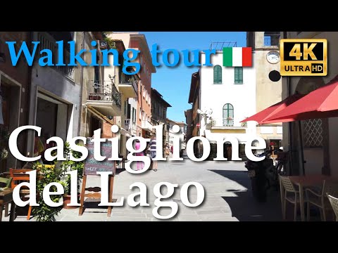 Castiglione del Lago in three views: old town, lake journey and Tulip Festival
 Van a pian’s Trasimeno circuit is a road journey that connects Castiglione with Passignano and San Feliciano. The film gives the town a regional setting: visitors see how the ridge-top centre relates to the lake road and to other communities around the shore. That makes it useful for planning a wider day rather than only a walk through the old centre. The route and conditions recorded in 2022 are a travel snapshot, not live navigation; check current roads, ferry service and timetables before copying the itinerary.
 Teletruria TV reports from the first 2024 parade of the Festa del Tulipano. This is the most event-specific film of the three: it shows the decorated floats, crowds and public celebration rather than treating the festival as a generic spring attraction. The town’s cultural heritage institute dates the festival to 1956 and links its beginnings to local tulip cultivation introduced in the 1930s. Each edition has its own theme and dates, so use the footage to understand the character of the tradition and consult the municipality for the current programme.