A small town on a wide horizon
Castel San Pietro Romano occupies the crest of Monte Ginestro, about 760 metres above sea level in the Prenestini hills east of Rome. Its compact stone lanes and stepped streets meet a broad landscape: roofs gather around the old fortress while views open towards Palestrina and the Sacco valley. ISTAT counted 838 residents in the whole comune at 31 December 2025; this is not a count of the historic centre alone. The village is intimate, but its story belongs to a much wider landscape of settlements, routes and defensive works.
Ancient walls, careful dates
The polygonal walls are the most striking evidence of that earlier landscape. The Comune dates the ring around the hilltop acropolis to the late sixth century BCE. Massive, irregular limestone blocks were laid dry, without mortar; the ring had two gates and a smaller postern, later altered when the Colonna strengthened the medieval site. These are not all the same wall or the work of one moment: the municipality distinguishes the acropolis circuit from lower stretches linked to the growth of the ancient settlement after the fourth century BCE.
The earliest occupation is less certain than the stonework suggests. The MuDi museum presents a late-Bronze-Age presence in the area, but the Comune notes that the precise location of the prehistoric and Orientalizing settlement remains unresolved. The hill may have served as an acropolis and lookout for Praeneste, and a religious role has been proposed; neither interpretation establishes when the present village was founded. Local tradition says that ancient inhabitants descended to found Praeneste, and that the Apostle Peter preached here and gave the place its name. The municipality itself identifies these as legends, not documentary proof.
From Colonna stronghold to civic village
In the medieval period, the Colonna family turned the summit into a fortified castrum. The MuDi history records destruction in 1298 during conflict with Pope Boniface VIII, further damage in 1436–37, and rebuilding directed by Stefano Colonna in 1482. After that restoration, the fortress gradually served the community: it stored food and hosted civic assemblies rather than serving only as a military outpost. Abandoned as a ruin around 1800, it was restored at the start of the twenty-first century and returned to public use. From the Rocca, the town’s height makes sense as a strategic choice as well as a place to look across the hills.
The seventeenth-century transfer of the fief to the Barberini brought new urban arrangements, including the main square. Above Piazza San Pietro stands Palazzo Mocci, built between 1732 and 1738 and now home to the MuDi visitor centre. The museum connects landscape and archaeology with church art, local photography and cinema. Its rooms tell the story of Adolfo Porry Pastorel, a pioneer of Italian photojournalism who later served as mayor, and explain why the village became a film set. Vittorio De Sica and Gina Lollobrigida are associated with Pane, amore e fantasia and its sequel; other productions, including I due marescialli, also used the town. These films are part of its cultural memory, not evidence that the settlement exists only for visitors.
Paths, churches and local food
A walk through the old centre can continue to the polygonal walls and the Rocca, then south to Santa Maria della Costa. The present church was built in 1682 near a hermitage associated in local history with Margherita Colonna. The municipality lists it as free to enter during daytime; worship times should be confirmed with the parish. Outside the centre, the MuDi’s nature routes point towards Monte Ginestro and the Valle delle Cannuccete, where the museum notes old aqueduct remains and a landscape shaped by water and woodland. Check route conditions and access locally before setting out.
Food is another way into the town’s identity. The giglietto, a dry biscuit shaped like a lily and associated with both Palestrina and Castel San Pietro Romano, is recognized as a Slow Food Presidio. Municipal storytelling connects its form with Barberini history; that account belongs to local tradition. Restaurants and seasonal visitor services appear in municipal listings, while no current sector statistics justify calling tourism the town’s dominant industry. The documented picture is of a small lived-in comune with a visitor offer built around heritage, food, events and nearby nature.
Getting there and planning a visit
By road, the Comune directs drivers along Via Casilina or Via Prenestina to Palestrina and then Via Pedemontana up to Castel San Pietro Romano. Astral’s UDR3 LA10 bus corridor links Zagarolo FS with Palestrina, the town and Rocca di Cave. Routes and timetables were reshaped, so check the current operator information before relying on a particular departure or school-day service. Palazzo Mocci houses the visitor centre, but the municipality asks visitors to contact the structure for opening times and notes architectural barriers. The walls are listed as freely accessible, while individual trails can have different conditions.
Castel San Pietro Romano rewards more than a quick viewpoint stop: allow time for the fortified ridge, the museum’s cinema and landscape story, a church or two, and the descent towards Palestrina. Its strongest appeal is how these layers remain close enough to read on foot, while the horizon keeps the wider Prenestini in view.
 Castel San Pietro Romano in video: the village, its streets and ancient walls
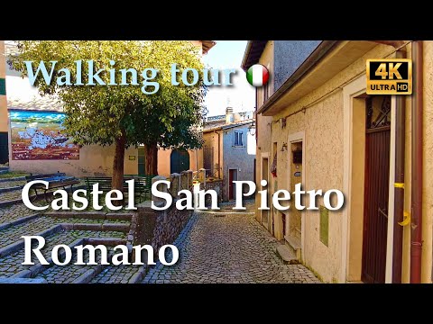 Presented as a 4K walking tour with captions, this 40-minute video takes a slower, street-level approach than the television feature. That format can help viewers understand the scale and uphill character of a compact hill town before planning a visit. It does not verify present-day access, museum hours or bus schedules, which should be checked separately.
 This 27-minute video is explicitly described by its uploader as a documentary tour of Castel San Pietro Romano's polygonal and so-called cyclopean walls. It is the most focused of the three for viewers interested in the ancient fortifications. The Comune's own page is the better reference for access and dates, since the wall circuit includes elements from different periods.