Åtvidaberg feels both carefully planned and close to the countryside. The town sits among lakes and wooded slopes in Östergötland, and its industrial past is visible in the street plan as much as in its surviving buildings. Statistics Sweden counted 6,963 residents in the mapped Åtvidaberg tätort on 31 December 2023. That is the statistical built-up locality, not the municipality: the municipal area is far larger and includes villages, farmland and forest.
A history with a clear record—and an earlier horizon
The municipality describes copper mining in the district as having medieval roots, but does not set a single, certain founding year for the settlement. Its visitor chronology instead gives a firm point of departure for the industrial town: the copper works at Åtvids ström were established in the 1760s. Municipal heritage records trace the works’ landscape, streets and buildings; the cultural-heritage plan says Åtvidaberg had become Sweden’s second-largest copper producer before the works closed in 1902. The medieval background is therefore a broad historical context, not a precise birth certificate. This profile follows dated records and does not use local legend as proof.
When copper production waned, other workshops and factories took root. The timber trade brought sawmilling and joinery; wooden wagon wheels and office furniture became important products. The company that grew into Åtvidabergs Industrier launched the mechanical Facit calculator in the 1930s. By the middle of the twentieth century, Facit had become an international office-machine group. Its premises expanded over several decades, while competition from electronic technology eventually forced a retrenchment and production wind-down in the 1970s and 1980s. The former Facit buildings now hold a mix of businesses, associations and education rather than a single factory line.
Read the town in its streets
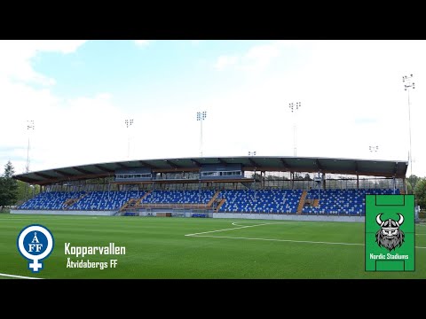
Start at Gamla Torget and follow the municipality’s signed industrial walk. Its map connects sites from the copper-works era to the Facit years, including Kopparvallen, Kalkugnen and Krutkällaren. The ten houses on Verksgatan, built by the copper works between 1777 and 1792 as workers’ homes, make the social side of industry especially tangible. The largest first served as an inn and later as Åtvidaberg’s first shop. They remain in place, but are privately owned; appreciate them from the public street rather than assuming access inside.
Near Bysjön, Villan offers another chapter in the town’s development. The late-nineteenth-century house was designed by Isak Gustaf Claesson for Theodor Adelswärd; the municipal heritage inventory notes that Facit founder Elof Ericsson later lived there. The centre’s garden-city character also survives in parts of Ågatan, Djurgården and Villahagen, where the 1905 plan sought a greener setting for the growing industrial settlement. The buildings and streets are evidence of different moments, not a single uniform “old town”.
Green routes and practical stops
The landscape opens out quickly from the centre. The Bysjön loop on Östgötaleden is described by local route information as about seven kilometres, marked in orange, with its start and finish in Åtvidaberg. It passes a grazed landscape and the Adelsnäs parkland, and brings the Temple and solar cannon into the wider local story. Much of the grounds around Adelsnäs is accessible for walking; some paths are uneven and the landscape is protected for its oak habitats, so follow signs and respect private property. North of town, Hallaholm has woodland walks and a marked route of about three kilometres, with viewpoints over the settlement.
Åtvidabergs museum, in its larger new premises opened in 2025, presents a timeline from mining to contemporary life and is a useful first stop for understanding the place before exploring outdoors. The municipality’s business profile shows how work has changed: across the whole municipality, small firms are common and manufacturing, construction and grocery trade are leading sectors; rural land-based activities occupy much of the territory. These are municipal figures, not counts for the town alone.
The town is on the regional Linköping–Västervik road corridor, and Östgötatrafiken lists bus line 30 between Åtvidaberg and Linköping. Check the operator’s live departures and service notices before setting out. Museum opening hours, cultural events and access to specific estate paths can change; confirm them close to your visit.