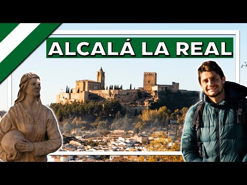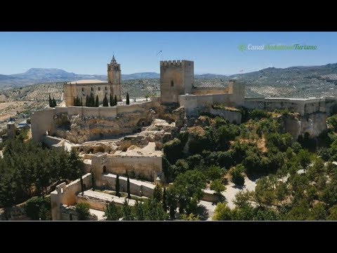
Alcalá la Real occupies high ground in the Sierra Sur of Jaén, on historic routes between Córdoba and Granada. La Mota fortress defines the skyline, but the present town is more than its walled hilltop. Its streets extended down the slope when the medieval frontier ceased to serve its military purpose. Walking between the upper enclosure and the lower town explains why its churches, squares and streets belong to several different periods.
History before the medieval fortress
The municipality records human presence in its territory from the Palaeolithic and identifies archaeological sites from the Neolithic, Copper and Bronze Ages, Iberian culture, and Roman and late Roman periods. These finds show long occupation of the wider area; they do not provide one foundation date for the town visible today. Nor do they show that Romans or Greeks built La Mota. The settlement's decisive role as a fortified place belongs to al-Andalus and, later, to the frontier between Castile and the Nasrid kingdom of Granada.
The town history places the arrival of Muslims in 713. Watchtowers helped control the surrounding routes in subsequent centuries. Alcalá gained particular political and cultural weight in the twelfth century: the municipality notes intervals of autonomy and the work of figures including Ibn Sa'id al-Maghribi. The high position offered surveillance but also made the town a target in military campaigns. After changes of control in the thirteenth and fourteenth centuries, Alfonso XI captured the place permanently in 1341. Until the conquest of Granada in 1492, Alcalá remained a gathering point for Castilian forces.
La Mota: a town behind the walls
The tourist office places the monumental complex at an altitude of 1,033 metres. A visit reveals successive defensive walls, gates, the citadel, cisterns, the pattern of old streets and remains of houses, cellars and stores. The Puerta de la Imagen retains features of an Islamic-period entrance; the Puerta del Peso de la Harina recalls checks on access to the commercial district. The walls did not all appear in one building campaign. The site includes Almohad fabric as well as later medieval and Renaissance alterations.
The Abbey Church represents the Christian phase of the hilltop. Alfonso XI established a royal abbey after the conquest. Over time, residents moved down to the slopes and plain. The municipal account says that in 1560 there were about 200 householders inside La Mota and 2,000 outside. These historical counts of householders are not directly comparable with a modern population census. French troops damaged the defences during the Peninsular War and used the church for military purposes. Fire and later neglect account for some of the ruins seen today. Municipal restoration begun in 1990 introduced a new phase of research and interpretation.
The lower town and countryside
After exploring La Mota, descend through the historic town towards the former Abbey Palace, now associated with cultural and visitor services. The change of level makes the town's gradual move beyond the walls easy to read. A slower walk can take in the Barrio de las Cruces and viewpoints rather than ending with a photograph from the road. The tourist office proposes routes among watchtowers and villages. The municipality includes sixteen villages and other inhabited places, so its rural landscape is an important part of the local story. Inside La Mota, the Frontier Life Interpretation Centre supplies context for the buildings and archaeological remains.
Opening hours and admission conditions for the fortress can change. Check the official visitor information, and allow time for slopes, sunshine and the size of the enclosure. The municipal tourist map also marks places to eat and stay. Hotels and other lodging are available in Alcalá itself, so visitors need not sleep in Granada or Jaén. Options include town accommodation and rural houses elsewhere in the municipality. For meals, consult the official directory and confirm that a selected restaurant is open on the day. Olive oil is a significant local product; the town council has developed olive tourism alongside cultural walks and hiking activities.
Getting there and planning a visit
Granada and Jaén are useful approach points from other regions. Córdoba lies on the N-432 corridor passing the Alcalá area, and the municipal visitor map shows the road in the directions of Córdoba and Granada. Travellers arriving from another country can first reach one of those larger cities, then check current onward transport and timetables. Drivers should distinguish arrival in the lower town from the ascent to La Mota and check where parking is permitted. The older streets and their gradients are best explored on foot.
Alcalá is larger than a small hamlet: it has an urban centre and many rural settlements. Any population figure should therefore specify whether it describes the entire municipality or only the main town. Spain's official statistics office publishes figures with a reference year and the relevant geographical unit. An unverified number would be less useful than making that distinction clear.