Wittnau lies about seven kilometres south of Freiburg, where the Hexental opens into a high, broad valley between the Schönberg and the western edge of the Black Forest. The municipality is small in area but not one undifferentiated village: its old cores are Wittnau at the foot of the Schönberg and Biezighofen on the Black Forest side. They have grown together, yet their historic shapes still read differently. Around Wittnau, the church, town hall and school formed the civic centre; Biezighofen retains farmsteads and modest houses once used by day labourers and craftspeople.
The federal municipal register counted 1,470 residents in Wittnau’s full municipal territory on 31 March 2026, across 5.04 square kilometres. That figure describes the municipality, including both settlement cores, rather than the built-up centre alone. Freiburg’s proximity makes Wittnau a lived-in community as well as a quiet base for walks. The local authority lists a primary school, childcare, churches, local businesses and community organizations; it also recognizes Wittnau as a recreation resort. Visitors should plan for a small village setting, with Freiburg and other Hexental communities close at hand for a wider choice of services.
A name in an eighth-century record, not a foundation legend
The municipality traces Wittnau’s first written mention to 786, when the name “Witunauia” appeared in a donation document associated with the Abbey of St Gall. Biezighofen is recorded separately in 806 as “Puazinchova.” These dates establish that the names were in written use by then; they do not tell us the exact age of the settlements or prove a Roman, Greek or other ancient foundation. The municipal history describes the early settlement pattern as two communities with different relationships to the land and to authority. For centuries, agriculture shaped everyday life: households relied on crops, livestock and the use of woodland.
The name Hexental invites a more fanciful reading than the evidence warrants. Wittnau’s own historical account says there are no witches to be found there and offers a possible linguistic origin in “Hag” or an older word rendered as “hags,” referring to hedges or an enclosed field. That is an etymological hypothesis, not a documented origin. The landscape itself is easier to verify: the valley rises from about 259 metres near its opening to more than 400 metres around Wittnau and Biezighofen. The Schönberg reaches 644 metres, while the eastern municipal area extends toward the western flank of Schauinsland.
A Baroque church and a working vineyard landscape
In the centre of Wittnau, the parish church is the most prominent historic building. The present church was built in 1795 after its predecessor had deteriorated; the municipal history names Johann Amann, the director of the Further Austrian building authority, as its architect and describes it as the last Baroque church in the Breisgau. The old court and manor structure also shaped the village. The municipal account considers it very probable—but does not claim certainty—that the former Dinghof survives in the form of the Gasthaus Hirschen. In 1811, records first refer to the political community as “Wittnau and Biezighofen”; the modern municipality retained its independence by joining the Hexental administrative association in 1971.
Wittnau’s slopes still tell a story of cultivation. Vineyards remain on the Hasenbuck, Großer Buck and Kapuzinerbuck, and the municipality describes Wittnau as one of Baden’s highest wine-growing places. The surrounding hills and wooded edges create a close succession of cultivated plots, meadows and forest rather than a single monumental viewpoint. From the three named hills, the local authority notes views across the Rhine plain and toward Freiburg. The area’s economy has changed from the older mix of farming, livestock and woodland work to a residential municipality near Freiburg with local businesses and wine-growing; the sources consulted do not provide a current employment breakdown by sector, so a more precise claim would be misleading.
Walk from the church toward the Schönberg
Walking is the clearest way to understand how the village fits its landscape. Wittnau’s municipal leisure page describes the Schönberg nature trail as two sections that meet near the Gasthaus Unterer Schönberghof and can be followed separately or together. The church in Wittnau is also given as a starting point. The wider network includes marked paths through the valley, vineyards and wooded slopes; conditions and diversions can change, so check local notices before setting out and choose footwear for hillside trails.
For a longer regional outing, the municipality points visitors to the Bettlerpfad, a walking route between Merzhausen and Badenweiler, and to cycling through the Hexental. Freiburg is the obvious nearby city for museums, the cathedral and its historic lanes; Staufen, Bad Krozingen and the Schauinsland area offer further day-trip options. These are regional excursions rather than attractions inside Wittnau itself, and public-transport connections and opening times should be checked individually.
Getting there and planning a visit
From Freiburg, the practical approach is by regional bus through the Hexental. In a service reorganization effective 1 September 2026, the Regio-Verkehrsverbund Freiburg renumbered the former line 7208 as line 440. Because routes and construction notices can change, look up the current connection to the Wittnau stop before travelling rather than relying on an older timetable. Drivers can follow the Hexental south from Freiburg; the municipal visitor information places Wittnau about seven kilometres from the city. The village works well as a half-day walk or as a slower stop on a longer Hexental itinerary. Check the latest bus timetable, trail conditions, local accommodation and food-service availability before departure.
 Wittnau in three films: the Bettlerpfad, Schönberg and local fire service
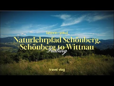 This Japanese-language travel channel describes a walk on the Schönberg nature trail, climbing toward the summit and descending to Wittnau. The subject matches the municipality’s own account of the trail and its village starting point. The footage offers a visitor’s perspective on the wooded hillside and the transition toward the wine-growing village; it should be treated as a personal route record rather than an official map or access notice. Check current signage and trail conditions before setting out.
 MrHeimspiel’s recording is identified as a full alarm for the Wittnau volunteer fire brigade near Freiburg. Its description names three Wittnau emergency vehicles, making it a direct glimpse of a local public service rather than a tourism film. It adds a civic angle to the landscape and walking videos: Wittnau is a functioning residential municipality with its own volunteer emergency response. The clip is from April 2024 and does not provide a guide to visitor services or current emergency arrangements.