Rautavaara sits in the northeastern corner of North Savo, near the borders of Kainuu and North Karelia. Forest, marsh and lake landscapes occupy far more of the map than the village centre. Statistics Finland counted 1,398 residents in the whole municipality on 31 December 2025. That small population is spread across a broad rural area, so a trip here is shaped by distance: the village offers everyday services and a few cultural landmarks, while many of the best-known outdoor places require a separate drive.
The municipality was established in 1874. Its present-day identity is closely connected to nature, but that landscape also records work and social history. The national park preserves traces of lake-ore processing and old forest livelihoods; Ylä-Luosta holds the story of a nineteenth-century forced-labour institution. Rautavaara is not only a base for hiking. It is a place where the relationship between people, forests, bogs and water can be followed across a small centre and an unusually varied hinterland.
Tiilikkajärvi: bogs, ridges and a pale sand shore
Tiilikkajärvi National Park is the headline landscape, shared by Rautavaara and Sotkamo. Founded in 1982 to protect lake, river, esker and mire environments, the park was significantly expanded in 2023. Rautavaara’s visitor information lists roughly 27 kilometres of marked trails. The terrain brings together pine-covered ridges, open aapa bogs and wilderness lakes; boardwalks cross wet ground, while sandy shorelines give the route a different, open scale.
Venäjänhiekka is one of the park’s memorable stops: a light-coloured beach on Tiilikkajärvi that visitors can reach by marked trail. The attraction is not a resort strip, but the contrast between sand, water and the quiet forest behind it. The national park is also a place for paddling, swimming, fishing where permitted, skiing and winter outings. Conditions matter in every season. Check current notices for route work, services, fire restrictions and weather, and bring the equipment required for a landscape with limited facilities.
At Tiilikanautio, a former croft site, the municipality points out traces of lake-ore processing in the yard. Iron-bearing material was once gathered from lake sediments and worked locally. The visible signs make the park’s cultural history legible without turning it into a reconstructed settlement. The route is a reminder that this apparently remote country supported practical livelihoods as well as travel and recreation.
Pumpulikirkko: a striking formation reached by a rough path
Pumpulikirkko is a natural rock formation in the park, shaped by the erosive force of glacial meltwater. Its name evokes a church-like chamber, but the interest lies in the geological form itself: a cleft and hollow enclosed by steep rock. The final approach is short, yet not effortless. The official route description warns that the last few dozen metres are rocky and demanding. Stay on the marked path and do not climb on the formation or into its hollow; that protects both visitors and the fragile site.
For a less technical outing, choose one of the park’s established loops and read its length and difficulty before setting out. The municipality describes Uiton kierto as a remote-feeling route through ridges, bog scenery and lake shores. The exact condition of boardwalks and access can change, and a route that looks modest on a map can take longer in wet weather. Tiilikkajärvi rewards a slow walk and a realistic plan rather than a rushed checklist.
More ways to experience the landscape
Closer to the village, Kipari offers a 2.4-kilometre loop across varied ground to a hilltop viewpoint. A lookout tower gives a wider view over Rautavaara’s forests and lakes, and a lean-to provides a place to pause with food brought along. It is a satisfying half-day outing when visitors want a panorama without committing to a long national-park circuit. Check the local route notice, especially in winter or after heavy rain.
At Älänne, Rouskunhiekka is a municipal swimming place beside a natural sandy shore. The nearby Kaivannonkierto is about three kilometres and is described as suitable for younger walkers. This is a different kind of nature day from Tiilikkajärvi: a family beach and short walk rather than a remote park excursion. The municipality maintains several swimming places, but facilities, water conditions and seasonal services vary. Confirm the current information before travelling specifically for a swim.
Metsäkartano, on a peninsula by Lake Ylä-Keyritty, combines a youth centre with a nature-holiday resort near the national park. The operator lists accommodation, meals, saunas, camping, equipment rentals and guided activities such as paddling and hiking. It can serve as a comfortable base for a multi-day stay, particularly for families and groups who want food and lodging close to outdoor routes. The campsite operates seasonally, and the full range of services changes through the year; book or check directly rather than assuming the summer offer is available in another season.
A village centre shaped by services and shared memory
Rautavaara’s centre is modest but useful as a base. The municipal visitor map lists a grocery store, pharmacy, hotel-restaurant, bakery café and fuel. Their opening hours matter in a sparsely settled area, where there may be few alternatives later in the day. The Lutheran church was built in 1982, while its bell tower dates from 1827 and belonged to the first church. The pairing of a newer church with an older tower is a visible link between the current community and the earlier parish village.
Local museum spaces are small and appointment-based. The school museum in Ylä-Luosta presents school objects, logging-camp equipment and household items in a former school; the collector’s museum is also arranged for groups by appointment. These are not walk-in attractions with guaranteed daily hours. Contact the municipality or local host ahead of time if they are important to your visit.
One of the municipality’s more difficult historical chapters belongs to Luostanlinna in Ylä-Luosta. In 1859, the county established a labour company there for men classified as vagrants, using forced work in peatland drainage. The institution was abolished in 1880. The municipal account preserves period newspaper records and notes that some foundations and a building with material from the period remain. This history deserves to be understood as coercive labour, not romanticized as a picturesque ruin; check locally whether any part of the site is safely and lawfully accessible.
Rautavaara’s economy is small-scale and dispersed. Municipal strategy treats local entrepreneurship and responsible nature tourism as priorities; on the ground, visitors encounter accommodation and food operators, outdoor-service providers and everyday village businesses. Nature supports the visitor offer, while the municipality’s own services and local associations shape the life of the centre. The best visit leaves time and money in those local services and respects the limits of the protected places that draw people here.
Getting there and allowing enough time
Kuopio is about 100 kilometres away by road, and the municipal overview describes it as a little over an hour’s drive. Nilsiä and Nurmes are each about 50 kilometres away; Iisalmi is around 70 kilometres and Kajaani a little over 90. These are useful regional reference points, but the final drive to a park trailhead is separate from reaching the centre. A car makes it much easier to combine the village, Tiilikkajärvi, Kipari, Älänne and Metsäkartano.
Coach services and journey planning should be checked for the exact date through Matkahuolto, which the municipality directs visitors to for current timetables. Rautavaara’s own weekly demand-responsive service is designed for residents’ errands and requires advance booking; it is not a visitor shuttle between attractions. If arriving by public transport, arrange the connection from the regional arrival point and any onward transfer before setting out. There is no reason to assume that a bus will meet a train or that it will reach a remote trailhead.
Two or three days make a more rewarding stay than a hurried loop. One day can focus on Tiilikkajärvi and Venäjänhiekka; another can pair the village church and services with Kipari or Rouskunhiekka; a third can be reserved for Pumpulikirkko or a guided activity from Metsäkartano. Rautavaara’s appeal comes from its space and quiet, so check the weather, opening hours, bus schedules and trail notices, then leave room for the landscape to set the pace.
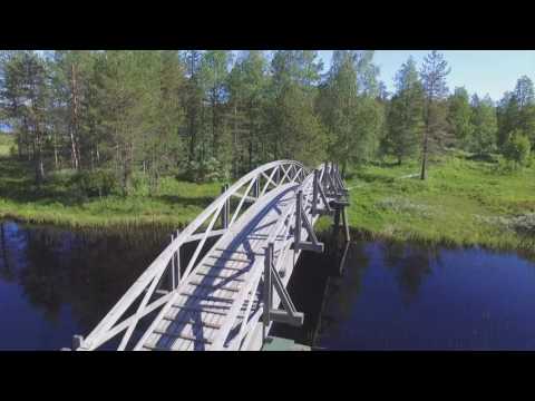 Rautavaara on video: Tiilikkajärvi, the 150-year celebrations and Rouskunhiekka
 Rautavaara Municipality describes this 2024 film as an impression of Rautavaarapäivät, the celebration held for the municipality's 150th anniversary. At just under two minutes, it serves as a compact record of a particular community event rather than a full programme or a promise about what will happen in a later year. The clip adds a human, civic dimension to a destination often introduced through its forests and national park. Visitors should consult the current event calendar for future dates and activities.
 The municipality's 38-second clip gives a quick look at Rouskunhiekka, which its description identifies as a popular swimming beach. This is a useful counterpoint to the longer outdoor routes: it points to a simple shore-side outing in the Älänne area. The recording dates from 2016, so it cannot confirm today's water conditions, facilities or access. Check local information before making the beach the centre of a trip.