Multia sits in the southern Suomenselkä uplands of Central Finland, where forests and marshes give way to lakes, small farms and a compact church village. Statistics Finland recorded 1,386 residents in the whole municipality on 31 December 2025. The centre stands between three clear-water lakes—Sinervä, Pieni Multianjärvi and Iso Multianjärvi—while smaller settlements extend along forest roads and waterways. This is a place to explore by making short, deliberate detours: a church, an old mill, a streamside trail and a long track once used to reach the parish all reveal different parts of local life.
A parish built around a church and a route
Multia became a municipality in 1868, but its settlement record reaches further back. The municipal visitor account says Multia appears in written records in 1564. It gives 1552 as a settlement date for the Nikara area; that earlier date is a local historical account, while 1564 is the archival reference. The distinction matters in a rural landscape where written records are sparse and communities took shape around farms, water routes and long distances between churches.
The Loviisa Charlotta Church was completed in 1796 and consecrated that December. Its present form is later: local cultural-environment material describes the long church’s neo-Gothic appearance as a result of a major 1900 renovation. An 1819 parsonage and other older buildings add scale to the church village. From Nikara, a 34-kilometre restored walking route follows the line of the old church road to Multia. For generations, residents crossed forest and marsh, used bridges and boardwalks, and stopped at farmhouses along the way. The route was restored for walkers in stages, with the first 20-kilometre Nikara–Pienimäki section completed in 2009. It is a demanding, historically evocative walk rather than a casual short loop; check current markings and consider walking only a section.
Water, mills and the working countryside
Small rivers and rapids once powered mills and helped sustain settlements spread across the municipality. At Uitamokoski, a mill history beginning in 1864 now has a public setting: the mill was inaugurated as a museum in 1968 and is owned by the local heritage association. The visitor service lists the building as open for free visits in the summer and early autumn, but seasonal arrangements can change. At Palsankoski, the landscape is more forceful. Three rapids form a roughly three-kilometre fishing area, while the nearby Palsankoski–Housukoski nature trail covers 1.5 kilometres. The trail is about 10.5 kilometres from the church village toward Karstula and has notable changes in elevation. Anglers should check current permits, closures and water conditions; old videos and archived permit pages are not a substitute for today’s rules.
Karhunahas, on the boundary with Petäjävesi, is a small gorge lake enclosed by steep rock walls. The municipal visitor description says a vehicle can approach to within a few hundred metres, making it a possible family outing, but the last stretch and ground conditions still require sensible footwear. A creator’s video offers a bear-hunting story about the name, but that explanation is not established by the municipal visitor information. The gorge is compelling without turning the tale into settled history.
Forest routes and village life
Multia’s visitor network extends beyond one headline attraction. The Poet’s Path follows a school route associated with poet Einari Vuorela, with sections through woodland and by the shores of Lake Sinervä. Joensuonkangas has an easy nature trail a little over two kilometres long, while the wider area offers routes for hiking, cycling, skiing and berry picking. Kiiskilänmäki, near Nikara, is identified by the municipality as a high point of southern and central Finland; a lookout tower has been undergoing stair work, so confirm whether it is open before planning a climb.
The economy remains rooted in the land while adapting to smaller-scale industry and tourism. The municipality names agriculture and forestry, wood processing, metal industry and tourism among its main sectors. This mix is reflected in the village landscape: working farms, managed forests, local businesses, seasonal events and visitor services sit alongside lakes and protected natural areas. In the centre, the municipal information point helps visitors find current details; local listings also include accommodation and food services, whose hours and booking requirements vary.
Getting there and making a day of it
Highway 18 and Highway 58 meet in the Multia area. The visitor portal lists Keuruu 19 kilometres away, Jyväskylä 60 kilometres and Ähtäri 53 kilometres. The nearest railway stations are Keuruu and Jyväskylä, while Tikkakoski is the nearest airport. The municipality directs bus passengers to Matkahuolto for current connections; do not assume that an intercity route stops at every village. A car or a carefully timed bus journey makes it easier to connect the centre with Palsankoski, the mill and more remote trailheads.
A practical day could begin at the church, continue to the mill museum during its open season, and then take the short Palsankoski nature trail. With more time, choose either the Karhunahas gorge or a section of the Nikara church road rather than trying to cover the full countryside in one visit. Confirm opening dates, fishing regulations, transport and trail conditions shortly before departure.
 Multia en tres videos: iglesia, garganta y pesca en rápidos
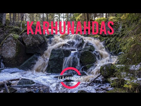 Elä retkessä follows an autumn visit to Karhunahas, the gorge lake on the Multia–Petäjävesi boundary. The 13-minute film shows the rocky setting and remains associated with an old mill, giving a sense of the terrain beyond the municipal centre. Its description offers a bear-hunting explanation for the name; that is the creator’s account, not a verified etymology. Check access and ground conditions before walking to the site.
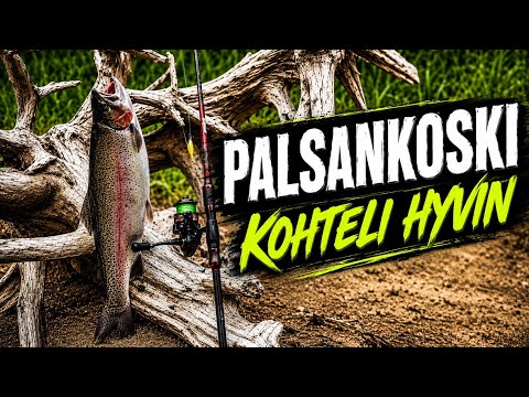 This 19-minute fishing video records Sami ja Kapa Kalassa’s midsummer-week trip to Palsankoski in 2026. The description says the water level suited fishing that day and that the pair had some fishing action. Those observations belong to one outing, not to present water levels, fish availability or a likely result for other visitors. It gives a recreational angler’s view of the rapids; check current permits, local closures and conditions before fishing.