Merikarvia lies on Satakunta’s northern coast, where the Merikarvianjoki reaches the Bothnian Sea and post-glacial land uplift continues to reshape the shore. Statistics Finland counted 2,834 residents in the whole municipality on 31 December 2025; this is not the population of the church village alone. Fields, river rapids, low rocky shores and skerry-filled waters all belong to the same coastal municipality. Its appeal comes from that contrast: inland routes lead to working villages and mills, while the outer islands recall generations of navigation and fishing.
Written history and local lore
The municipality’s historical account records a 1303 dispute over hunting grounds, fishing waters and wilderness rights between people associated with Sastamala and Sastmola. It dates a boundary marker called Saksan kivi to 1348, on the present Merikarvia–Siikainen boundary. These references document land and water use, not a proven ancient town or Roman-era foundation. Merikarvia’s parish separated from Ulvila and Pori in 1639; the account gives about 200 residents and 21 houses at that time. Municipal government began in 1865. The area also has a bilingual past: roughly half its residents were once Swedish-speaking, services were initially held in Swedish, and a 1739 ruling required Finnish sermons every other Sunday. The old church named for Queen Sofia Magdalena dates to 1776.
A local story says the Creator scattered leftover stones around Merikarvia and promised herring shoals to make life on the rocky coast possible. It is folklore, not an origin record. The municipality also presents the possible derivation of “Merikarvia” from karva, an old general word for fur, as a hypothesis rather than a settled etymology. Those distinctions leave the documented story of coastal work and changing communities intact.
A shoreline in motion
The land is still rising after the last ice sheet. The municipality estimates uplift at about seven millimetres per year, slowly exposing new rocks and skerries while former shorelines move inland. The result is a coastline of irregular bays and narrow passages: attractive to birdwatchers and boaters, but demanding careful navigation. The Ouran archipelago belongs to the Natura 2000 network. Its 1850s beacon, Oura Pooki, once guided vessels toward Merikarvia harbour, and Ouraluoto served as a pilot station until 1968. Boat transfers from Krookka are arranged by local operators; check availability, weather and landing conditions before setting out.
Krookka harbour and Lankoski
Krookka shows how the coast has supported fishing, boatbuilding and shipping. The guest marina now sits among fish-smoking businesses and seasonal cafés, restaurants and cultural events. The municipality’s 2026 visitor guide lists toilets, showers, water, waste-tank disposal and a fuel pump among the marina’s services. Cafés and other visitor businesses may close outside the summer season, so check ahead. Inland at Lankoski, the river passes an old working landscape. The stone-arched bridge dates to 1887; nearby mill buildings retain water-powered structures. The municipality identifies Kahvimylly as the place where Antti Ahlström began his business activity. A riverside nature path and the old bridge make a worthwhile stop, although rapids, dams and a hydroelectric installation call for care close to the water.
River activities, islands and everyday services
The Merikarvianjoki has about 24 kilometres of continuous fishing-permit water, including roughly six kilometres of rapids and faster current. Many stretches have lean-tos, fireplaces, toilets and bins. A joint body representing three local fishing associations manages the fishing arrangements, and anglers need the relevant permit. Municipal visitor information also describes paddling from Lankoski toward the sea in spring and autumn, plus guided trips in the estuary. Water levels and access change, so use current local guidance rather than an old video as safety advice. Oura offers open-sea light, birds, exposed rocks and maritime history; Ouraluoto’s former pilot station and barracks are available for booked stays, not as a continuously open museum. Merikarvia’s economy combines farming, forestry, coastal fishing, mechanical wood processing, metal and plastics businesses, and visitor services. In the centre, everyday options include a grocery shop and pharmacy. Accommodation, restaurants, cafés, a campground, farm visits, fishing guides and boat trips are available through local providers, with seasonal hours.
Getting there and making a day of it
Highway 8 runs through Merikarvia. The municipality lists Pori at 53 kilometres and Kristiinankaupunki at 60 kilometres to the north. Urpolan Liikenne serves the Pori–Merikarvia route, and express coaches stop on Highway 8. The nearest railway stations are Pori, about 50 kilometres away, and Parkano, about 100 kilometres away; Pori also has the closest airport. Confirm the exact stop and timetable with Matkahuolto, Seutu+ or the operator. A good day can begin in the church village, continue to Lankoski’s bridge and riverside path, then reach Krookka for the harbour and a pre-booked boat trip to Oura. Leave time for weather and seasonal opening changes.
 Merikarvia en tres videos: Oura, Krookka y el río
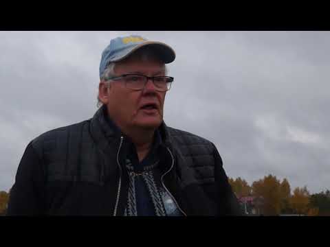 This six-minute introduction is the first instalment in a small film series about Krookka, led by local guide Lauri Hakosalo and published by the Merikarvia media group. The description says the project recorded more material than could initially be completed, giving this harbour-side story a community perspective. It is useful as a sense of place, but the video dates from 2018; check today’s marina services, businesses and seasonal openings before visiting.
 In this 24-minute fishing video, the creator says he tests Enni lures supplied by the Vilke lure maker and includes moments from several visits to the Merikarvianjoki. It is one angler’s personal record, not an official river guide, a report of current water conditions or evidence that a particular catch is likely. Treat it as a glimpse of recreational fishing and check permits, local rules and conditions before planning a trip.