Conca dei Marini is best understood vertically. The municipality rises above the Amalfi Coast road, while its old lanes and churches occupy the slope and the Marina’s small cove sits below the cliffs. The result is not one compact seafront resort but a set of places joined by steep roads, stairs and views across a curved stretch of coast. Come for the sea, certainly, but leave time for the settlement above it: that is where the town’s maritime and agricultural histories meet.
A small municipality, not just a beach
Conca dei Marini is in the province of Salerno, in Campania. ISTAT counted 644 residents in the whole municipal territory on 31 December 2024. The figure describes the comune, not the Marina beach or the historic centre alone. For visitors, this distinction explains the difference between the quiet, inhabited hillside and the busier shoreline in the bathing season. Piazza Olmo is a useful point of orientation in the upper town; Marina di Conca is a separate descent toward the water.
The landscape makes everyday movement part of the visit. From the SS163, the municipality says the Marina can be reached by a small boat or by descending roughly 240 steps. Its pebble shore is pressed against the rock face, with whitewashed Mediterranean houses and the small chapel of Madonna della Neve embedded in the cliffside. The cove is free to enter, but the access is not wheelchair-accessible. It is a place to plan for sturdy footwear, heat and the climb back up, rather than to treat as a beach reached directly from the road.
What the records say—and what they do not
Stories that give Conca an unbroken Greek, Tyrrhenian or Roman foundation go further than the evidence allows. The national heritage catalogue itself says the origins are uncertain. It records a hypothesis that the area was associated with a Tyrrhenian settlement called Cossa and describes a Roman phase, but this is not proof that today’s town began as a documented colony or that its present community descends in a simple line from that ancient place. The responsible history starts with that uncertainty, then follows what can be documented more securely.
Conca’s position encouraged seafaring, trade and fishing alongside work on steep agricultural land. The heritage catalogue places its port within the wider maritime world of nearby Amalfi and records a tuna trap established around 1700 that remained active until 1956. That fishery is a substantial part of the town’s documented past; it should not be mistaken for a measure of present-day employment. Today, visitors encounter a local economy shaped visibly by hospitality, food services and seasonal access to the coast, while citrus terraces remain part of the cultivated landscape.
There is also a brief administrative chapter: a decree joined Conca to neighbouring Furore in 1928, and the two communes were separated again after the Second World War. This detail matters because the coast’s small settlements have changed boundaries as well as livelihoods. The surrounding Amalfi landscape is not scenery outside the town’s story; it shaped where people farmed, landed boats and built homes away from the immediate waterline.
Churches, a convent and a pastry with a local story
Several churches are scattered across the slope rather than grouped in a single square. San Giovanni Battista, also known as Sant’Antonio da Padova, occupies a high rocky position above the inlet. The municipality says the building’s precise origins are unknown, although records naming a parish rector date to 1416. Inside are three naves; outside, the maiolica-covered cusp of the bell tower and the Baroque facade give the church a distinctive profile. Its entrance is not listed as wheelchair-accessible.
At the upper entrance to town, Santa Maria de Grado has a longer documented institutional history. The site is recorded from 1370. A Pandolfi family altar followed in 1616, and in 1680 Vittoria Pandolfi established a Dominican conservatory dedicated to Santa Rosa da Lima; the monastery was completed in 1681. Local tradition connects this convent with the sfogliatella Santa Rosa. Campania’s regional food account places the pastry’s creation in the seventeenth-century convent, and the municipality’s event history recalls an abbess sharing it with residents on the saint’s feast day, 30 August. The town has held a public celebration around that date; check the municipal calendar for the current programme rather than assuming a fixed annual event format.
The upper lanes also lead toward San Michele Arcangelo and San Pancrazio Martire. The municipality describes San Pancrazio as surrounded by an old olive grove and reached by a stairway. Together, these churches make a useful walking itinerary through a settlement whose religious landmarks are also orientation points on the hillside.
From fishing grounds to lemon terraces
The sea and the slope have always been close in Conca’s economy. Its historic tuna fishery linked the community to coastal labour; in the cultivated ground above, terraces make farming possible on steep terrain. Campania Region lists Conca among the municipalities within the Limone Costa d’Amalfi IGP area and describes the region’s lemon gardens as terraced, labor-intensive landscapes. That regional designation does not mean every lemon sold in town qualifies, nor do regional production totals describe Conca alone. It does explain why citrus, preserves, desserts and lemon-based products are part of the wider visitor experience.
The clearest natural attraction is the Grotta dello Smeraldo, a partly flooded karst cave below the coast road. Sunlight enters through an underwater opening and gives the water its green appearance; mineral formations shape the interior. A ceramic nativity scene was placed on the seabed in 1956. The cave is reached from the road by stairs and lift, or from the sea, and visits are arranged through an operator. Conditions at sea, seasonal opening and the way a visit is run can change, so confirm access and tickets before setting out. It is a focused visit, not a reason to skip the village above.
Getting around and planning the day
There is no railway station in Conca dei Marini. The coast road SS163 connects it with Amalfi toward the east and Praiano and Positano toward the west, but traffic, narrow carriageways and seasonal congestion can make short distances slow. SITA Sud’s published 5080 route lists Conca stops on a service linking the Amalfi area with Agerola, Gragnano, Castellammare di Stabia and Naples. The operator updates timetables and warns that some school-calendar services may be suspended; check the date-specific schedule, the exact stop—Bivio Conca or Piazza Olmo—and the return journey before travelling. From Amalfi, the local bus or a boat is more practical than assuming the beach lies next to the upper-town stop.
For a rewarding half-day, begin in the upper centre, visit the churches that are open, pause for a Santa Rosa pastry when local bakeries have it, then choose either the descent to Marina di Conca or the cave visit. Doing both is possible, but involves stairs or operator transfers and deserves more time in summer heat. Nearby Amalfi offers a larger transport hub and additional services; Furore and Praiano continue the coast’s sequence of cliffside settlements. Treat Conca as a place to explore slowly, not simply a viewpoint passed from a bus window.
 Conca dei Marini on film: the sea cave, a village portrait and a TV visit
 At nearly fifteen minutes, this Wonderful episode by 360gradiwebtv offers a broader editorial portrait of Conca dei Marini. Its published description names journalist Brigitte Esposito as writer and presenter and credits Gerardo Tartaglia and Angelandrea Falcone with the direction and filming. The longer format can help viewers get a general sense of the place before they arrive, complementing the cave-specific first video. It remains a produced web-TV feature, so treat it as an introduction rather than a complete itinerary or a current source for opening hours and services.
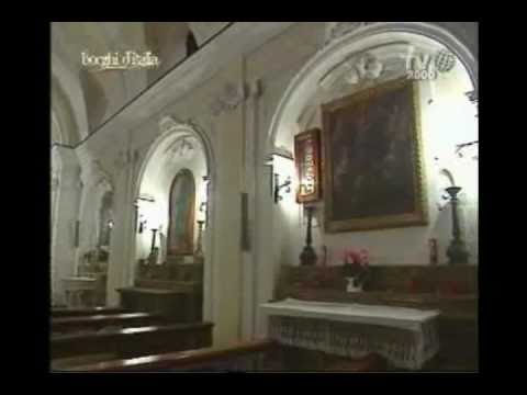 TV2000’s Borghi d’Italia contribution is labelled part one of a two-part feature on Conca dei Marini and runs for just over fourteen minutes. Published in 2011, it is the oldest and most archival item here. That age is useful when watching for how a television programme framed the town at the time, but it also sets a clear limit: transport, access and visitor services may have changed. Read it alongside current municipal and operator information, and as a separate television perspective rather than a substitute for the newer portrait and the dedicated Emerald Grotto tour.