Tempio Pausania is an inland Gallura town shaped by two kinds of stone: the granite under its feet and the Nuragic masonry scattered across its wider territory. Set below the wooded massif of Monte Limbara, it feels more like a working regional centre than a staged village. Its shaded lanes, civic squares and churches sit within reach of mountain forest, archaeological sites and the cork landscapes that still inform local identity.
Residents and the municipal area
ISTAT’s 2024 demographic-balance file records 13,036 residents in the Comune di Tempio Pausania on 31 December 2024. This is the census-adjusted total for the entire municipality, not a headcount of the compact historic centre, a single neighbourhood or seasonal visitors. The distinction matters here: the town serves as a point of reference for several inland Gallura communities, while its administrative territory also includes rural and mountain landscapes.
A documented history, with interpretation kept separate
The municipal visitor history traces the written name “Templum” to an ecclesiastical document of 1173. It identifies the later medieval form Villa Templi as a rural centre in the Giudicato of Gallura and notes Tempio’s elevation to a diocesan seat in 1506. The same local account says that scholars most often connect the name with the Latin word templum, understood there as a slope or escarpment; that is an etymological proposal, not a proven account of how the settlement began. Nuraghe Majori provides much older, material evidence for human activity in the area: the regional heritage record dates it from the end of the Early Bronze Age to the Final Bronze Age and documents a preliminary excavation and restoration in 1986.
The historic centre is a walkable sequence of grey-granite buildings, chiefly eighteenth-century in character, rather than a single monument. Piazza Italia and Via Roma lead toward Piazza San Pietro, where the cathedral, Oratory of the Rosary and church of Santa Croce form a close ensemble. The cathedral’s first phase is medieval; its present form reflects a major rebuilding in 1832–39. Corso Matteotti links central squares with the Parco delle Rimembranze, while Piazza Gallura and the town hall show how civic life shares the same stone-built setting. Piazza Faber adds a contemporary public artwork dedicated to Fabrizio De André.
Work, culture and a mountain landscape
Granite, cork and wine are more than visitor shorthand: municipal planning documents identify them among the area’s resources and productive traditions. A 2021 municipal performance plan describes the cork chain around Tempio and neighbouring Calangianus, while the current local tourism portal highlights Gallura food and wine. These are dated or broad descriptions, not current employment statistics. Shops, cafés, restaurants, accommodation and public services make Tempio a practical base between the coast and the interior.
The town’s cultural calendar is especially visible during Lu Carrasciali Timpiesu. The municipal history page says the earliest surviving written record of carnival festivities dates to the first half of the nineteenth century, while the modern cartapesta parade took shape in the 1960s. Re Giorgio, the central carnival figure, belongs to this evolving community tradition; a single ancient origin story should not be substituted for that documented history.
For a short outing beyond the centre, the municipality’s “City of Stone” walk runs from the railway station to Piazza Gallura. A separate driving or cycling itinerary continues from Parco delle Rimembranze to Nuraghe Majori and on toward Monte Pulchiana. The Nuraghe lies on SS 133 toward Palau; the regional heritage directions specify a turn at about kilometre 1.5 and a further roughly 450 metres on an unpaved track. Its unusual mixed plan combines a longitudinal corridor with vaulted rooms built in the local granite.
Monte Limbara offers a different scale of excursion: the municipal route guide lists road access toward the summit as well as marked walking paths and forest tracks. Its more demanding Vallicciola–Ghjucantinu–Madonna della Neve trail is about 2.5 km one way, marked E and mostly uphill over uneven, rocky ground. Check weather, trail conditions, access and transport before setting out. Museum, church and event hours also change; confirm them with the current municipal visitor service.
 Tempio Pausania in three lenses: town, Nuraghe Majori and carnival
 Diversamente Sardi’s 8-minute-56-second item, published on 21 May 2023, is specifically titled Nuraghe Majori - Tempio Pausania (SS). Its description identifies the site’s position on a granite rise at 498 metres and presents the nuraghe in relation to other monuments in the surrounding uplands. That makes it the archaeological focus of the three, complementing the general town introduction and the cultural film in the final slot. For architecture, chronology and directions, compare the regional heritage record; the video metadata alone does not establish visitor access or opening times.
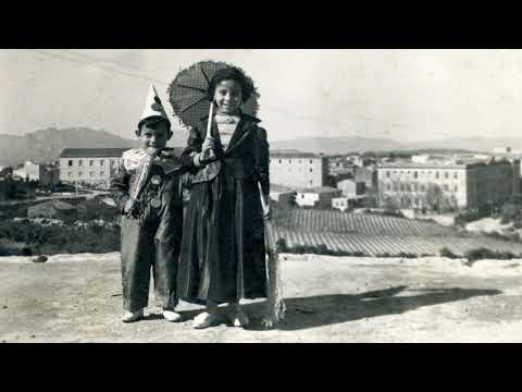 The official Gallo Frisgiola - Carrasciali Timpiesu channel published this 36-minute-43-second documentary on 5 February 2025. Its title, Gjògliu Puntògliu – Il Carnevale di Tempio attraverso l’etnografia visiva, and description explain that it looks at the carnival through an audiovisual workshop with students from Tempio’s Liceo Dettori, guided by photography and film professionals. It offers a community-made cultural perspective, distinct from the destination overview and archaeological profile. The review follows the published title and description and makes no claims about individual scenes.