A small city with a long horizon
Laitila is a compact city in Southwest Finland, but its story stretches across several very different landscapes. The settlement began beside a shifting coastline; later, roads linking Turku and Rauma with Uusikaupunki and Häme crossed here, helping the church village become a local centre. Today Highway 8 carries traffic past a place where medieval stonework, farm buildings, village roads and modern industry all belong to the same everyday landscape.
Statistics Finland counted 8,400 residents in the whole municipality on 31 December 2025. The city lies in the Vakka-Suomi area of Southwest Finland, with Rauma and Uusikaupunki among its neighbouring cities and Turku 60 kilometres away. That position makes Laitila useful as a base for exploring the smaller villages and countryside between the coast and inland towns. It also explains why the place has never depended on one monument alone: its character is spread between the centre, old village communities and fields shaped by centuries of work.
Archaeology without a Roman-origin myth
The municipal history records traces of fishing and seal-hunting communities at Leinmäki and Nästi around 5,000 years ago. At that time, much of present-day Laitila was still under the sea. More than 200 Bronze Age burial cairns and objects from later centuries show that people used and travelled through this region over a long period. Among the finds are a drinking horn from the fourth century and a provincial-Roman wine ladle discovered in the village of Salo. They are striking evidence of connections and exchange; they do not mean that Laitila was founded as a Roman settlement.
Local folklore adds another layer. Stories of Kalevanpojat—legendary giants—are part of the area's oral tradition, and a feature in Untamala churchyard is associated with one of those tales. The story belongs to local memory rather than verified archaeology. This distinction matters in Laitila, where tangible finds are already rich enough without turning legend into a false date or origin story.
Churches and a farmstead in their own setting
St Michael's Church is the most powerful architectural landmark. The municipality dates its completion and vaulted paintings to 1483. The Heritage Agency describes it as a medieval stone church, and the murals belong to the circle of the Pietari Henrikinpoika school. They were covered in the 1860s and brought back into view in a major restoration in 1967–1968. A new extensive renovation began on 1 September 2026; the parish says the church is out of use during the works, so visitors should not plan on entering until it confirms reopening.
North of the centre, Untamala gathers village history into a smaller scale. Its wooden St Peter's Church dates to 1785, while burial mounds and the old village landscape point to a settlement older than the modern road network. A different picture of rural life awaits at Kauppila's enclosed farmstead in Koukkela. The buildings remain largely in their original places and range from the late 17th century to around 1900; a barn contains agricultural machinery, while many household objects belonged to the farm itself. The site has been a museum since 1975 and is recognised as a nationally valuable built environment. It is open seasonally: the published 2026 summer dates have passed, so check the municipal page before travelling. The café and accessible toilets operate during the opening season.
A working town, not a museum set
Until the 1960s, agriculture and forestry were the main livelihoods. The city then invested in industrial jobs and housing. Poultry farming became a lasting part of Laitila's identity; the rooster on the city coat of arms holds a traditional tool associated with wooden-vessel making. The municipal history also identifies a glass factory, an egg-products company and a beverage producer among the town's industrial names. This is a useful counterpoint to the historic farmyard: Laitila's economy has changed, but production and local enterprise remain visible parts of its character.
Culture continues through public events rather than monuments alone. Munamarkkinat, the Jazzkukko festival and the Kustaa Hiekka cultural week appear in the municipal calendar, alongside exhibitions and performances. Check the current program before choosing dates. The city's public services and commercial centre make it possible to combine a heritage visit with ordinary errands, while the seasonal museum café gives a more local pause when Kauppila is open.
Walking the countryside and planning the route
Vähä-Tulejärvi offers a marked nature loop of about five kilometres, with 15 interpretation boards. The city's guide describes a shorter 2.5-kilometre out-and-back option to board eight; walkers and mountain bikers share the trail. It gives visitors a way to encounter the wooded landscape without committing to a long excursion. Check route conditions and signage before setting out, especially after storms or during seasonal maintenance.
By road, Highway 8 connects Laitila with the coastal route between Turku and Rauma; the city lists Turku at 60 kilometres and identifies Rauma and Uusikaupunki as nearby cities. Regional buses may help travellers who do not drive, but services change by date and route, so use a current timetable rather than assuming a daily connection. A rewarding first visit combines the church village from outside while renovation continues, Untamala or Kauppila when access permits, and the Vähä-Tulejärvi walk. Laitila is best understood as a broad cultural landscape: archaeological traces, lived villages, local production and practical modern services, all within a short drive of one another.
 Three Laitila videos: St Michael's Church, Vähä-Tulejärvi and Kauppila
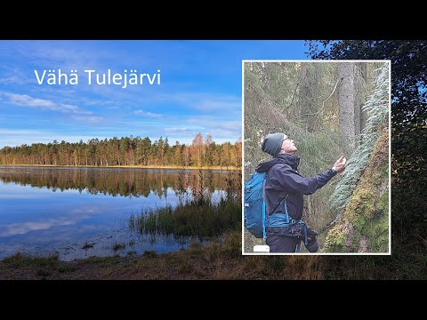 This film is titled “Peace of the old forest” and names Vähä-Tulejärvi in Laitila. The municipal trail guide describes a marked loop of about five kilometres with nature interpretation boards, plus a shorter return option. The video offers a separate nature-focused introduction alongside the church and farmstead films. Its imagery does not confirm today's route conditions, so check current signs, maintenance and weather before going.
 Laitila Info's short video is devoted to Kauppila's enclosed farmstead in the village of Koukkela. The municipality describes the site as a historic rural estate whose buildings remain largely in their original setting and span several centuries; it has served as a museum since 1975. The video is a useful visual introduction to the farmyard's cultural landscape. Kauppila opens seasonally, so verify the current visit arrangements before travelling.