Konnevesi is a lake district municipality in Central Finland where the town centre, waterways and forest trails sit close together. Statistics Finland counted 2,404 residents in the whole municipality on 31 December 2025. The central settlement is a long ribbon along Highway 69 rather than a dense old town, and the surrounding villages open toward the waters of North and South Konnevesi. Visitors come for the national park and fishing, but the place also offers a local museum, a working village centre and routes that connect inland Finland with a historic waterway.
A name with several possible stories
Even the name has no settled explanation. The municipality records several theories: one links it to the old Sámi word konte, meaning reindeer; another to konne, a word associated with mischief or magic; and others to words for difficult, remote land. These are possibilities, not proven etymologies. The uncertainty is fitting for a landscape that has long been approached by water, forest paths and shifting borders.
Konnevesi and neighbouring Rautalampi belonged to a wilderness region along the Rautalampi water route. The municipal history names Olli Varis as the first recorded settler in present-day Konnevesi: he established himself at Istunmäki in 1552. Pietari Nikinpoika Kolari followed at Särkisalo two years later. Most settlers came from Savo as the Swedish Crown encouraged permanent settlement along its eastern hinterland. Farming and livestock keeping expanded, while valuable fish from the rapids were controlled through Crown fishing rights. Those records give the place a working history rooted in land and water, rather than a legendary ancient foundation.
For centuries, the waterways remained the practical routes between settlements. The municipality’s history identifies the Kuopio–Vaasa road completed in 1786, Pietari Brahe’s road, as the first official road through this wilderness area, though water transport continued to matter into the 20th century. Konnevesi’s independent municipality was approved in 1919 and began operating in 1922. Its grey-stone church, designed from plans by Ilmari Launis and built with local stone, was consecrated in 1923. It is a landmark of the young municipality, not a medieval church.
Protected lake scenery and a river of rapids
Southern Konnevesi National Park was established in 2014 and extends across Konnevesi and neighbouring Rautalampi. Its islands, clear water, rocky shores and steep rises make it a place to explore by foot or boat. The park’s Kalaja route climbs to the top of Kalajavuori. Metsähallitus lists the circular section at 3.9 kilometres and grades it demanding; the climb is steep and uneven, so it suits hikers in good condition. The full approach makes the outing longer, and current route notices should be checked before setting out.
Close to the park, Konnevesi’s seven-rapid route has a different character. Siikakoski, Taikinainen, Karinkoski, Kellankoski, Yläinen, Keskisenkoski and Hannulankoski form a sequence valued for wild lake trout and fly-fishing. Fishing is managed under conservation conditions, permits may be required, and seasonal closures can apply. The municipal Partiomajan circular trail follows the water’s edge through forest past Taikainen and Karinkoski to a simple resting place. Its signed start is about five kilometres from the centre; signs mark 800 metres to Taikainen and 1.6 kilometres to Partiomaja. A lean-to, fire site, toilet and firewood are listed at Karinkoski, but check current facilities and fire restrictions.
Häyrylänranta and the everyday village
Häyrylänranta is the practical gateway to the national park: the municipality describes it as a guest harbour, caravan area and family beach, with boat cruises departing from its pier. It is also a useful place to pause before or after a walk. Accommodation ranges from a small family hotel in the centre to lakeside cottages and simpler camping options. The municipality lists groceries, restaurants, a pharmacy, health and wellbeing services and a Matkahuolto point in the central village; hours and seasonal availability should be confirmed.
For culture closer to the main street, Galleria Käpy combines changing art and craft exhibitions, workshops, a café and local products. It also serves as a visitor information point, particularly in summer. The Konnevesi local heritage museum at Multamäki gathers twelve 18th- and 19th-century log buildings in a loose farmyard arrangement. Its large windmill is visible from Kauppatie. The municipality lists the museum as a summer attraction, so check the current opening period.
Getting there and making a visit
Jyväskylä is about 60 kilometres from Konnevesi. The central village lies on Highway 69, and local road directions lead onward to the trailheads and lakeside stops. In summer 2026, Outdoor Express published scheduled connections from Jyväskylä to Southern Konnevesi; this was a seasonal service on specific dates, not a year-round bus. Check current Matkahuolto and Outdoor Express information before relying on public transport. Boaters can reach the area through the Keitele–Päijänne canal network from the south or the Neituri canal from the north, subject to current navigation conditions.
A satisfying short stay can pair the village centre and Galleria Käpy with Häyrylänranta, then reserve a separate day for the park or the seven rapids. Allow extra time for the Kalaja climb, and arrange fishing or boat services in advance. Konnevesi’s appeal is not a single monument but the way its everyday services, historic route, rapids and island-studded lake landscape fit within one small municipality.
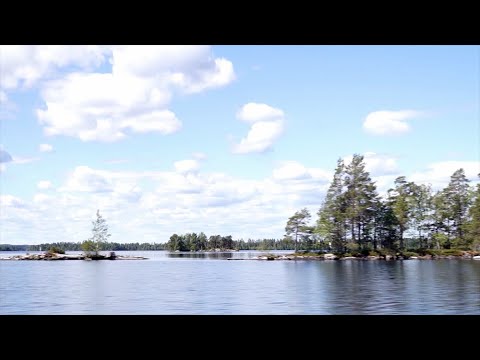 Konnevesi by water and trail: three views of the national park
 Johannes Ansaharju’s video is described as a December 2025 hike in Southern Konnevesi National Park. The winter date makes it a useful counterpoint to the area’s summer boating and hiking image: it documents a cold-season visit rather than suggesting that every trail or facility stays equally accessible. The title and description establish the park and timing, while the official route service should guide visitors on current trail conditions, safety and permitted overnight use.
 Roihut vaeltaa’s June 2026 upload follows a trip on the Three Mountains Hiking Trail in Southern Konnevesi. Its title and description identify the route and the park, making this the clearest of the three videos for hikers considering a longer foot journey. Treat it as a dated personal trail trip, not a substitute for official route grading or current notices: the Kalaja area includes steep, uneven sections, and conditions can change with weather and maintenance.